Alfoz de Lloredo
 Download the cheat sheet and go!
|
Alfoz de Lloredo is sea and mountains. It’s made up of 7 villages: Cigüenza, Cóbreces, La Busta, Novales, Oreña, Rudagüera and Toñanes. What can Alfoz offer visitors? It offers several kilometers of coastline with beaches and high cliffs where an Indian lives. It’s also got villages with well-preserved architecture and churches that you can’t even imagine. As well as delicious cheeses and thousands of lemons! Would you like to come? Let’s start with learning where its name comes from: the word Alfoz comes from the Arabic word al-hawk which means “district.” And the word Lloredo derives from laurel. Therefore, it means “district of the laurels.” The oldest preserved remains date back to Prehistoric times. There are several caves like Las Aguas cave in Novales, which has paintings and engravings inside; and was discovered in 1909 by H. Alcalde del Río. Also discovered around this time were Cualventi cave in Oreña and El Linar cave in La Busta. They cannot be visited. A very important route passes through Alfoz: the Camino de Santiago, which enters via Oreña and exits through Luaña Beach towards Ruiloba. And the pilgrims may leave with a great taste in their mouths if they try the cheese that the Trappist monks make in the monastery. So if you’re a cheese lover, come try a wedge. In Alfoz great food and music come together at the Bolao Folk Festival which takes place at the beginning of July. It’s just one more reason to visit! Next, we’ll reveal the ESSENTIALS and EXPLORING sections:
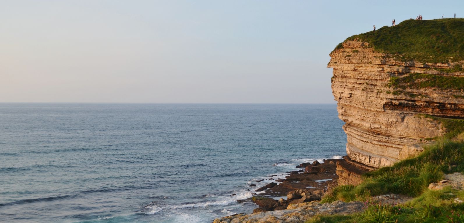
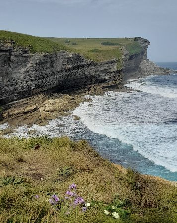
El Bolao is one of the most amazing and recommended places to visit on the coast. In fact, it’s been the setting for advertisements and films like Altamira, which starred Antonio Banderas. It has two access points:
Luaña is located in the village of Cóbreces. In the middle of the beach flows La Conchuga stream, which is the natural border between Alfoz and Ruiloba. It’s the perfect place for sunbathing, swimming and surfing. To the right of the parking lot is a path that will lead you to the Luaña lookout, which is a great place for a picture! It’s common to see pilgrims among the beach goers, as the beach is right along the Camino de Santiago.
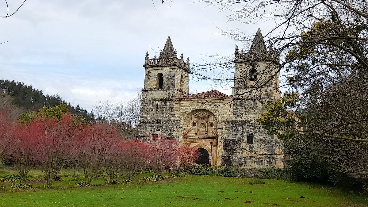
Apart from Luaña Beach and the cliff, Cóbreces has two buildings that especially stand out: San Pedro Advíncula church and Viaceli Monastery. The church is of a Gothic Revival style and it has two prominent towers. Viaceli Monastery was financed by brothers Antonio and Manuel Bernaldo de Quirós along with the agricultural institute at the beginning of the 20th century. In Cóbreces there are other buildings of interest like the Villegas Foundation, the church cemetery (the old monastery), El Castro manor from the 18th century and the Villegas tower house from the 17th century.
No matter how absent-minded you may be, if you visit the capital of Alfoz, you’ll notice that there’s a tree that prevails in all the gardens: the lemon tree. In Cantabria it’s known as “the village of lemons.” That’s because thanks to its particular mircoclimate and soil composition, this citric fruit has found a good place to grow. The best way to get to know this village is to wander around the streets and enjoy:
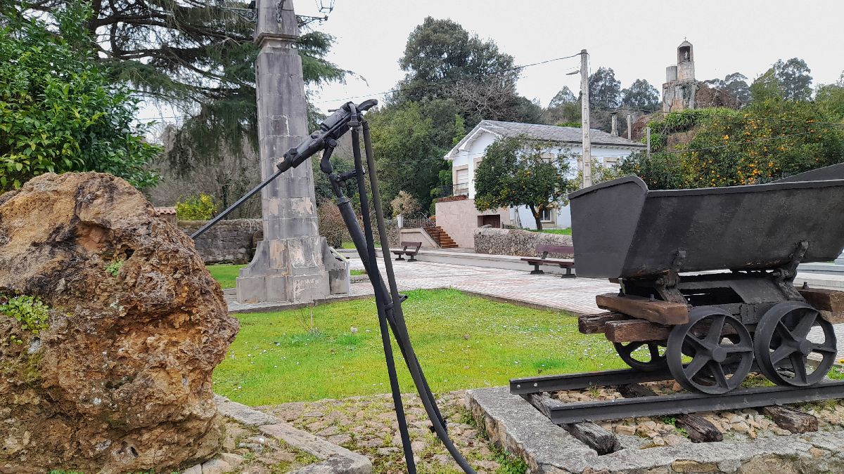
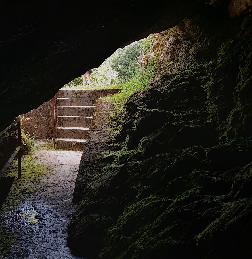
This route is a simple walk that’s just over 2.5 km. You can start at the center of Novales that way you can take advantage and see the beautiful architecture. The detour to Las Aguas cave is pointed out at the town’s exit going towards Cóbreces. Taking this road, you’ll see to the side the old facilities of the San José Mine which remained active until the 1990s. Continuing along the path next to the stream, you’ll soon reach the end of the line. You’ll find a first cave which you can enter a few meters so we recommend bringing a flashlight. This cave is the point where the stream reaches the surface. From here is the access point to Las Aguas cave, although its interior is closed to the public. Inside there are Prehistoric paintings and engravings discovered by H. Alcalde del Río in 1909. To return, take the same path back to Novales. Technical information and recommendations: ► Starts and ends: Novales Notes:
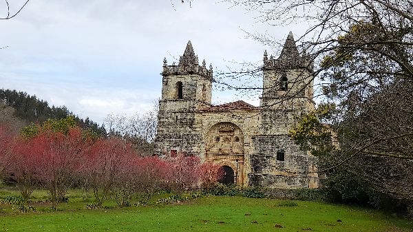
It is located 1 kilometer away from Novales. San Martín de Tours church is impressive as well as very surprising. Juan Antonio Tagle Bracho (an Indiano who earned his fortune in Lima, Peru) ordered its construction in 1743. It is of Baroque style and its floor plan is in the shape of a cross with two twin towers to the west. The inside of the church can be visited in summer. For more information, consult the town hall. Telephone: 942 72 60 51 You’ll also see the village has some beautiful grand houses like the Allende House from the 17th century, the House of the countess of Casa Tagle from the 20th century and the 17th century house where the church’s benefactor was born. As you can see, there are lots of reasons to put Cigüenza on your must-see list.
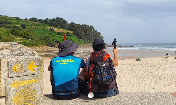
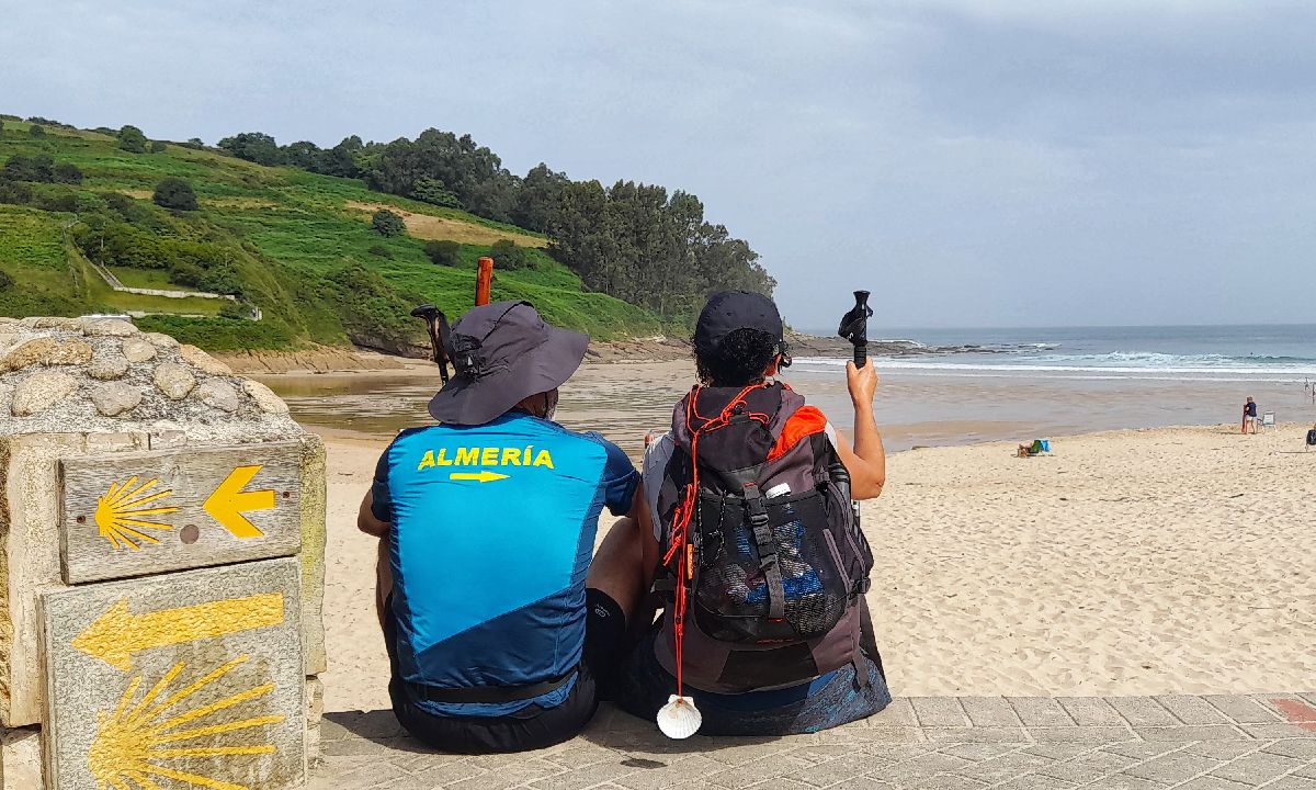
In the 9th century, the tomb of Santiago (St. James) was discovered in what was known as Libredón forest, in the northeast of the Iberian peninsula. A church was founded which the first pilgrims began to visit. In the 11th century it was solidified as a pilgrimage center at a European level. It’s often said that there are as many routes as there are pilgrims; although it’s true that throughout time, several main routes were developed, like the Portuguese, the Silver, the English, the French and the Northern Ways. Within Saja Nansa, the Camino passes through the municipalities of Alfoz de Lloredo, Ruiloba, Comillas, Valdáliga, San Vicente de la Barquera and Val de San Vicente. Every year, thousands of pilgrims from all over the world pass through Saja Nansa on their way to Santiago de Compostela.
Oreña is the entrance point to Saja Nansa from Santillana del Mar. It has a little bit of everything from sea to mountains:
Toñanes is the access point to Pico de la Molina, the highest point of the El Bolao cliff. There are signposts along the way so you don’t get lost, but if you do, it’s a great opportunity to come across some incredible houses like the Gómez Carandía home.
We suggest parking your car and going for a walk or cycling between the towns of La Busta and Rudagüera. In La Busta you’ll come across grand 18th century houses like the ones belonging to the Rivero and Bustamante families, the Gutiérrez del Rivero home; or San Miguel church which was founded in the 10th century, but has since undergone some reconstruction. In Rudagüera you’ll also see the grand Pérez Calderón family home, and the grand home of the Gutiérrez de Lloredo family, as well as the Lloredo medieval tower. You can go down to the Saja River and have a picnic or take a dip in the river if you’re feeling brave. If you want to continue on your walk, you can go to Cildad lookout point, which has panoramic views of Torrelavega and the mountains in the background.
|

 BOLAO CLIFFS
 El Bolao holds a secret: a rock shaped like the head of an Indian. Are you up to finding it?
 Although you can reach both places by car, we suggest parking in the designated areas and going on foot to avoid overcrowding.
 LUAÑA BEACH
 CÓBRECES
 NOVALES
 LAS AGUAS CAVE ROUTE
 CIGÜENZA

