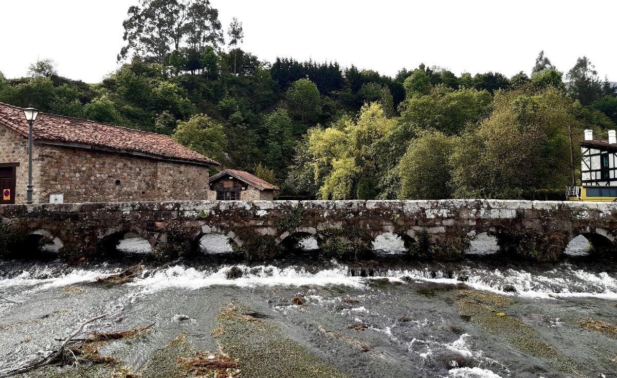
Ruente
 Download the cheat sheet and go!
|
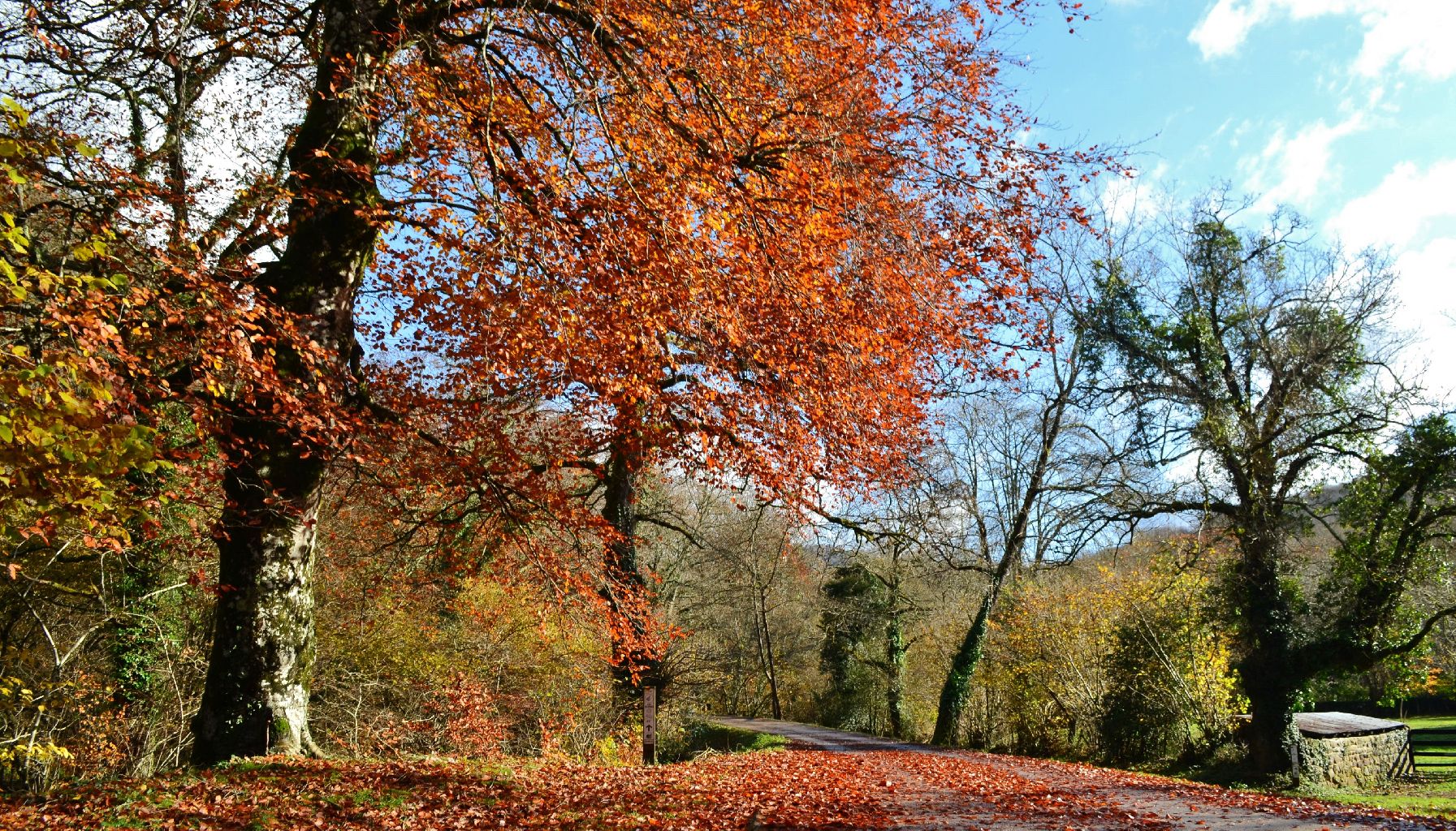
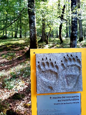
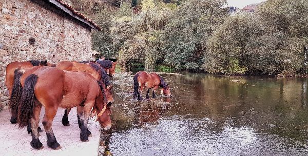
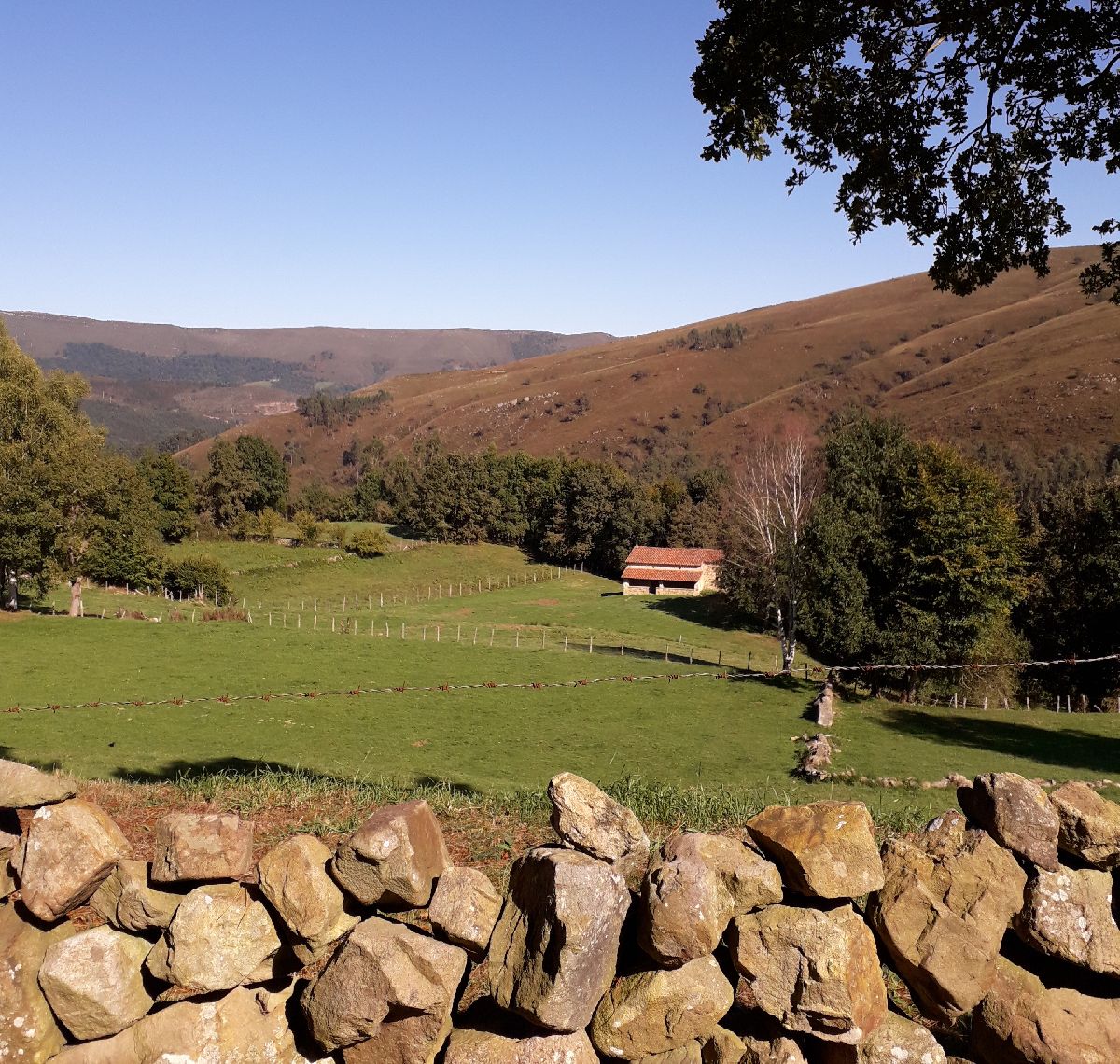
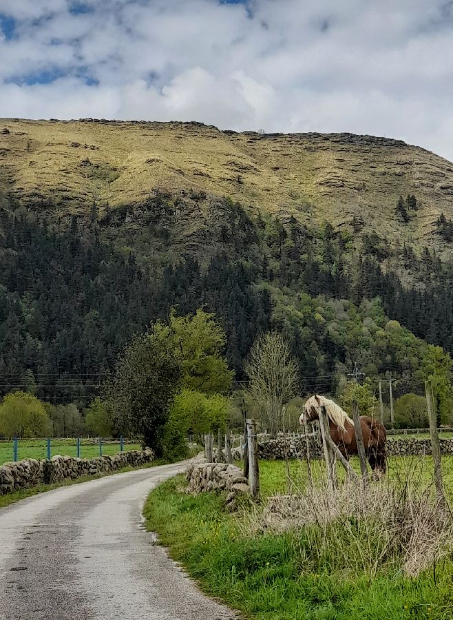
The municipality of Ruente is located next to the Saja River and the Sierra del Escudo de Cabuérniga. There are four key words that describe the area: nature, gastronomy, architecture and mythology. And soon you’ll understand why. First, we’ll mention the towns that it consists of: Barcenillas, Lamiña, Ruente and Ucieda. Each one has a street and a place that will pique your interest because they’re living history. As a brief introduction, it’s important to note that the municipality’s oldest remains are preserved in the San Fructuoso Hermitage. Here you can find a sarcophagus, some columns and other pre-romanesque remains. Furthermore, Ruente was an important stop on the way to Castile. In the 9th century, it was transited by the Foramontanos, people who were going to repopulate the meseta. And in the 16th century, it was part of a commercial route called the Camino Real. If you like driving, we recommend following the road to the Palombera mountain pass: it’s one of the most beautiful scenic routes in the area! During the 17th and 18th centuries there was a wave of emigration to America. These people who made their fortune abroad, Indianos, built large houses and baroque mansions when they returned; and you can still see them throughout the municipality. Moreover, its natural environment is very important. Most of its territory contains some means of conservation: the Saja Besaya Natural Park, the ZEC (Special Conservation Area) waterway of the Saja River and several Unique Trees which are significant due to their size, age or peculiarity, like the Mellizo (Twin), the Belén or the Bujilices Beech. Next we’ll reveal more of its ESSENTIAL information, as well as clues and fun facts to make your visit this municipality more fun.
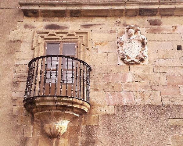
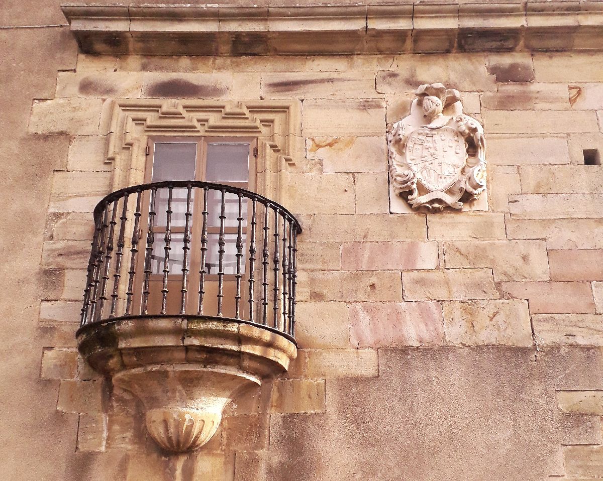
The name Barcenillas comes from the word “bárcena,” which refers to the fertile land near rivers. A walk through the village is like looking at a catalog of traditional montañesa houses from the 17th and 18th centuries, when the Indianos arrived to build their homes. Furthermore, Barcenillas was a village of stonemasons. You can see the intricate stonework in all of the houses, especially on the windows, which are adorned with flowers, crosses and filigrees.
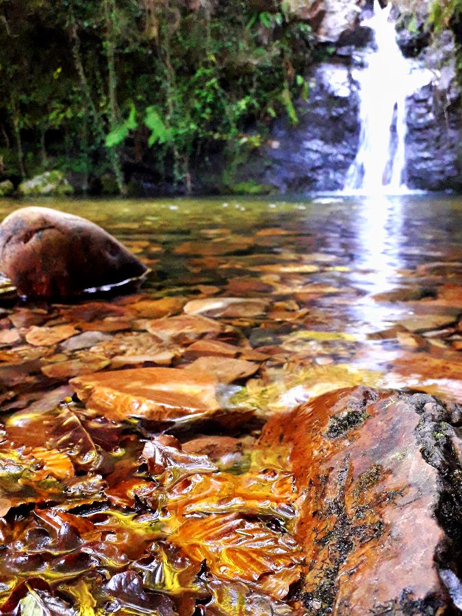
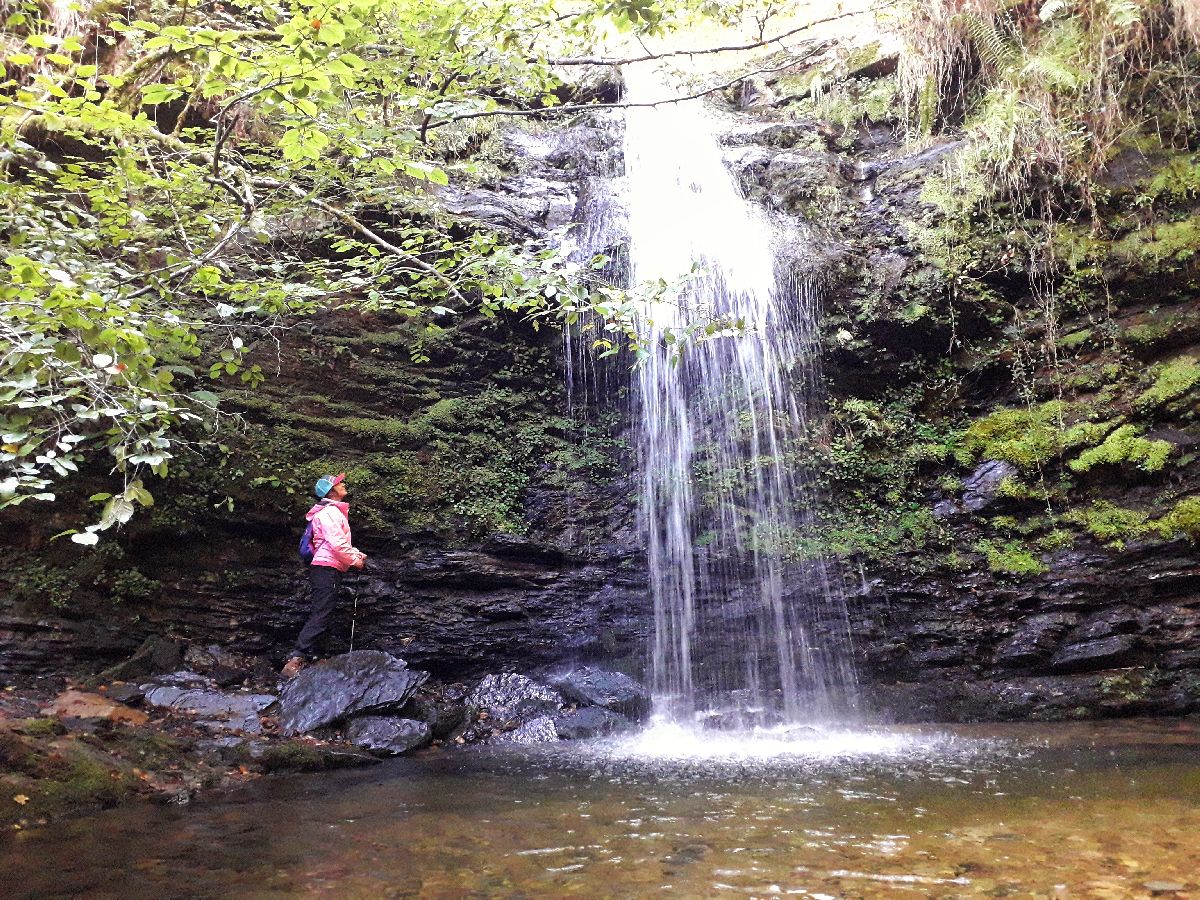
Are you ready to walk? The Lamiña Waterfalls, also known as the Úrsula Waterfalls, is the perfect hike to do with the family. It’s not too difficult, although you have to be a walker because the route is approximately 8 kilometers. You can set off from Barcenillas or Lamiña, as both paths meet at the same point. Once you’re at this point, you go up a hill that will lead you to a cattle grate, which is a metal grill on the ground which serves to prevent livestock from escaping because they are scared of stepping on it and breaking their leg. The descent is indicated to the right of the gate. Warning! Once you reach the river, there’s no bridge, so you’ll have to cross it very carefully. Then, you go along the left of the river, and voila! You’ve arrived at the magical place where the waterfalls are. As a warning, the roads that lead to the waterfalls cannot be accessed by car, despite signage in some areas stating the opposite. Only residents’ and agricultural vehicles are authorized. You will see the signs just outside of both towns. In Barcenillas, there’s a large parking lot next to the church where you can leave your car, that way you can enjoy the landscapes much more. Technical information and recommendations: ► Starts and ends: Barcenillas o Lamiña Notes:
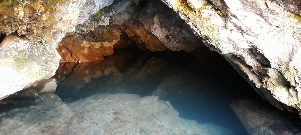
Ruente has a MUST visit: La Fuentona (The Big Fountain). The name could be somewhat confusing, because it’s not actually a fountain, but a river! This spring flows intermittently. The dry spells (which can last hours or minutes) are called “secas,” and they’re closely tied to Cantabrian mythology. In this case it’s referring to the legend of the ‘anjana,’ a Cantabrian fairy. It’s a magical place that immediately transmits a sense of calmness.
Within its three neighborhoods—Ucieda de Arriba (the top of Ucieda), de Abajo (the bottom) and Meca, you’ll be able to see interesting buildings like a shrine (a small building with religious symbols pointing out the main road), La Canal House, or Escagedo Mansion, among others. Did you know there are several famous figures linked to Ucieda? We’ll highlight some of them: two artists, María Blanchard (Cubism) and Antonio Quirós (Figurative Expressionism); and Consuelo Berges (translator, journalist and writer). Ucieda is one of the access points to the Saja Besaya Natural Park. Several hiking and bicycle trails have their starting points at the La Campa or Casa del Monte recreational area, which we’ll tell you more about soon. But there’s more...mark your calendar for the first Sunday of September, when the Cocido Montañés Festival is celebrated. This stew is one of the star dishes in the area and we recommend you try it. 1o| To take a step-by-step tour and to get to know Ucieda better, we recommend visiting the following link: self- guided tour Ucieda
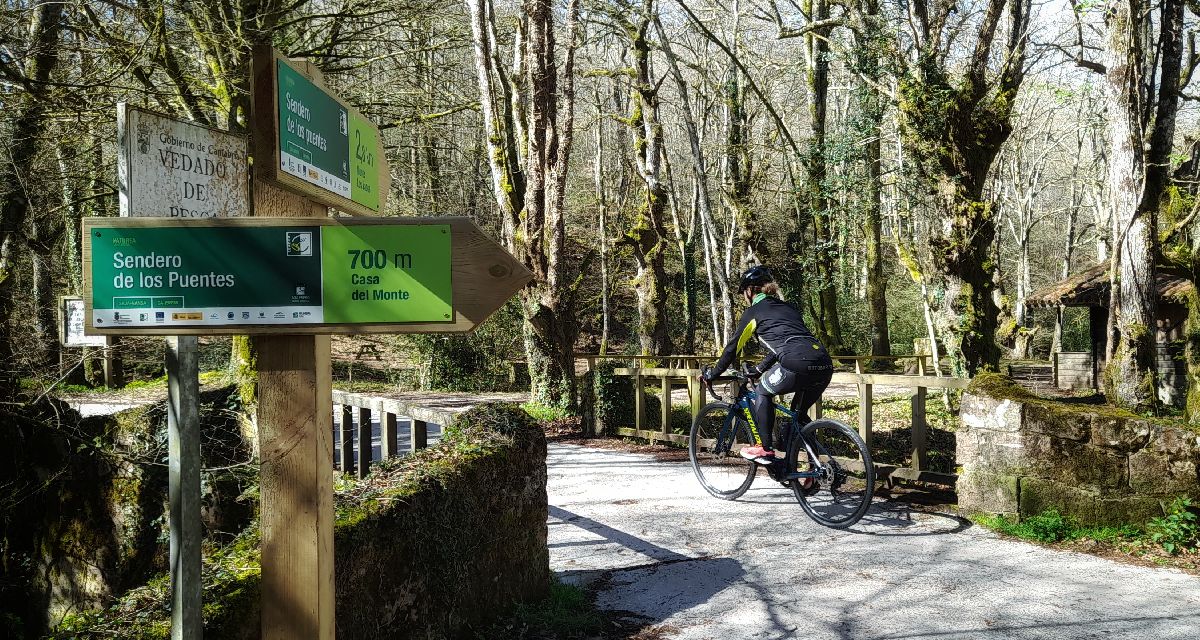
This trail for the blind is a simple 2-kilometer route. It’s located in the La Campa de Ucieda (also known as Casa del Monte) recreational area. The start of the trail is about 700 meters ahead. Although you can arrive by car, we recommend going on foot, that way your 2-kilometer route becomes 4. It’s highly recommended for families because it can be turned into an educational experience: take a blindfold, and whether you’re a child or adult, try reading the signs throughout the first kilometer of the route with your hands. Each sign represents animals or embossed plants and their descriptions are in braille. Technical information and recommendations: ► Starts and ends: Parking lot 2 km away from Casa del Monte recreational area Notes:
The Cantos Redondos viewpoint is located on the summit of the Sierra del Escudo de Cabuérniga. You have to go on foot via the Piralba- Cantos Redondos Route to get here. The path begins in Santibáñez. You have to be in shape to do it, though, because the climb up has an incline of 535 meters. However, the effort is worth it. The 360° panoramic views are amazing! On a clear day, you can see parts of the Asturias and Cantabria coasts, Picos de Europa (Peaks of Europe), Peña Sagra, the Cantabrian Mountains, and the valleys all around.
The route of Monte Aa or of the Singular Trees is one of the most frequented in the valley. This itinerary takes you into one of the mature oak groves of the region where cagigas -as Quercus robur oaks are known here- abound along with beech, holly and riverside forest. The most striking specimens are century-old oaks cataloged and protected as Singular Trees. One of the best known was El Cubilón, whose remains you will see protected as a monument by a fence. On the promenade you will see the Mellizo, the Belén and the Arriaga. It will seem incredible to you, but these trees were born around the year 1400, when Columbus had not yet arrived in America! It is a real luxury to be able to enjoy them and that is why we ask you to respect and care for them.
Technical data and recommendations: ► Start and end: Ruente Notes:
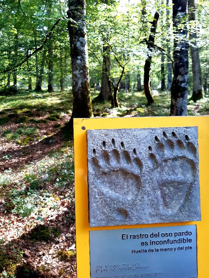
SAJA BESAYA NATURAL PARK Do you want to disconnect from your day-to-day routine and be at one with nature? Well, you’ve come to the right place! ? We’ll answer a few basic questions for you:
Next we’ll suggest a few trails:
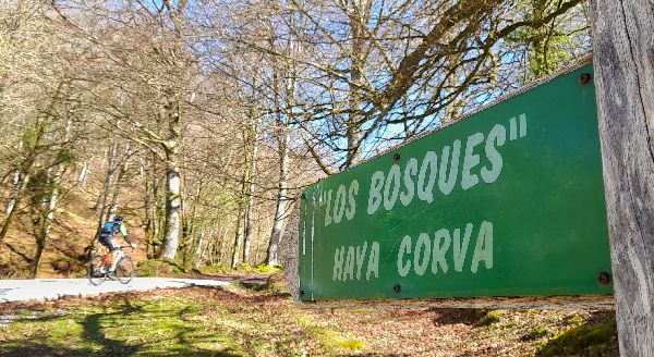
This is one of the most well-known routes in the area. The track goes through Monte Río Los Vados or Mount Ucieda, an oak grove that also has other species like beeches and tree heathers. You’ll have the chance to see specimens like the Roble Tumbado (Lying Oak) or the Haya de Bujilices (Bujulices Beech tree) which are part of the Unique Trees of Cantabria inventory. The starting point is Casa del Monte. Follow the track, and at about 700 meters you’ll come across a bridge and a sign that takes you on a detour to the right towards Braña del Moral. The hike up is 4 kilometers. Once you pass Casa del Andinoso, you’ll turn to the left. This is the start of the hiking trail that will take you through the mountains where you can see the Unique Trees in the forest, as well as the ruins of Rozas, a village abandoned in the 17th century. You can also see remains of coal cellars, where charcoal was used as fuel in homes and in the ironworks industry. At the end of the trail, you’ll reach the Vuelta de la Cotera, where the track merges with the Hayacorva route and takes you back to Casa del Monte. Technical information and recommendations: ► Starts and ends: Parking Casa del Monte recreational area Notes:
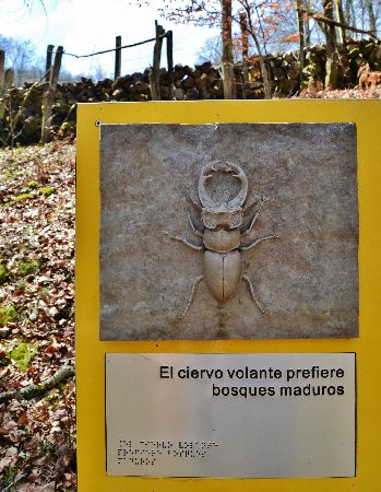
This route runs through the northeastern part of the Natural Park. It’s entirely on a path, so it’s perfect to do either on foot or mountain bike. The landscape is a mix between meadows, oak trees and beech trees in the shadier areas. Set off from Casa del Monte and follow the same path as in the previous trail. After about 700 meters you’ll reach a fork in the road. Continue toward the area called Casa de Tío Mero until you reach the junction. Since it’s a circular route, if you take the path to the left, you will do the trail clockwise; if you continue straight, you’ll do it counter-clockwise. The path goes uphill until you reach a place called Las Palancas; from this point on, the path is downhill. If you pay close attention, you may see deer, foxes, or strange invertebrates like the Alpine longhorn beetle (Rosalia alpina) or the stag beetle (Lucanus cervus). Technical information and recommendations: ► Starts and ends: Parking Casa del Monte recreational area Notes:
|

 BARCENILLAS
 Someone who was closely linked to Barcenillas was Francisco Pérez González, more commonly known as Pancho. He was Honorary Adviser of the PRISA group and co-founder of the Santillana publishing house along with Jesús Polanco.
 Do you want to learn more? Click on this link from the Esencia de Cantabria website.
  LAMIÑA WATERFALLS
 RUENTE
 UCIEDA
 BAYONES RIVER TRAIL FOR THE BLIND
 Download more information and track HERE
 CANTOS REDONDOS VIEWPOINT
 MONTE AA ROUTE
 The forest track can be traveled by mountain bike but to enter the interior path, it is not allowed for bicycles.


