| |
An interesting thing you should know about the region of Saja Nansa is that it’s comprised of 18 municipalities and one territory: the Campoo – Cabuérniga Commonwealth.
It’s a unique case of joint ownership in Cantabria and one of the best examples of sustainable management of a territory. We’ll tell you about some of its features and how it functions:
- Where is it? It’s located between the valley of Cabuérniga and Hermandad de Campoo de Suso.
- How big is it? Approximately 7,000 hectares (7,000 football fields).
- How many villages does it have? None. The only inhabitants are the livestock and wild animals.
- What resources does it have? Pastures, hunting, fishing and timber.
- Who manages it? The municipalities of Cabuérniga, Hermandad de Campoo de Suso, Los Tojos and Ruente.
- How long has it been run like this? You have to go back to 1497, when an agreement was reached to take advantage of the pastures and mountains. Although the Royal decree which is enforced today is from the 18th century!
- What kind of vegetation is there? There are harvest fields, oaks, beeches, hawthorns, holly and heather plants, and pastures.
- What was the traditional system of land use like? The area is separated into high and low pastures. Using a calendar, the towns split up the areas so they can take the cattle up to the mountains. That way the land is used sustainably.
In the past, each village took up all of the cattle together with a shepherd—the cowboy—and two boys who assisted the cowboy called “el sarruján” and “el becerrero.” Each town had a cabin in the mountains where the cowboy and his helpers stayed during their corresponding period.
- How did they know who the cattle belonged to? Every village had an identifying brand they marked on the animals’ skin with a hot iron.
- Does this tradition continue today? Yes, a short-distance transhumance is still done, but the main difference is that the cattle is usually transported by truck, rather than walking up. Another difference is that there’s no shepherd to take care of the livestock. The owners go up periodically to check on the cows and horses.
- Are the cows and horses enclosed? No, they’re roaming free, so if you decide to go up to the Palombera mountain pass, proceed with caution, because they’re the first priority and inhabitants of the commonwealth.
- What happens when the livestock returns? There’s a great festival in which there’s a parade with all the livestock. In the Valley of Cabuerniga it’s called La Campaná, while in Carmona it’s La Pasá.
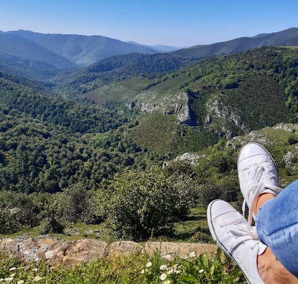
- What can I visit? The Campoo – Cabuérniga Commonwealth is located within the Saja Besaya Natural Park. Therefore, its main attraction is that it’s the perfect place to enjoy nature: go on hiking trails, biking routes or driving through are some of the way you can explore the area. Next, we’ll tell you about the things you can do.

 CAMBILLAS RIVER PATH CAMBILLAS RIVER PATH
It’s a simple walk that allows you to enjoy the Saja Besaya Natural Park at any time of the year. The beech forest that surrounds it makes it the perfect option for the hot summer days. While in autumn, it transforms into a beautiful ochre-colored path.
After passing the park Research Center, you’ll find a parking lot where you can leave your car. About 200 meters up the road, there’s another road to the left that you should take. After about 3 kilometers, you’ll notice a sharp curve and that the path gains altitude. To the left there’s a trail that will lead you to your destination: the recreational area. It’s got picnic tables so it’s the perfect place to eat or rest. It’s a linear route, so take the same path back to return.
There’s a sign in the road that points to MINA LÁPIZ and interesting fact about it is that it’s a plumbago mine that was exploited in the 19th century. This mineral is a graphite used to make pencil lead.
Technical information and recommendations:
? Starts and ends: parking next to Mina Lápiz on the road CA-280
? Length: 7 km
? Duration: 2 h
? Level: easy
? Type of track: linear
? Incline: +42m./ -42 m.
? Type of path: walking path
? Signpost: no
? Drinking water: no
Notes:
- We recommend downloading the track of the route on your phone.
- Wear good hiking shoes and take a walking stick.
- Only leave your footprints on the ground: throw any trash you accumulate into the correct bin when you return.
- Live in harmony with the environment: observe animals from a distance and respect the plants. If you walk quietly you may find some pleasant surprises.
- Because it’s located within the Saja Regional Hunting Reserve, we recommend checking the hunting calendar.
 Download more information and track HERE Download more information and track HERE
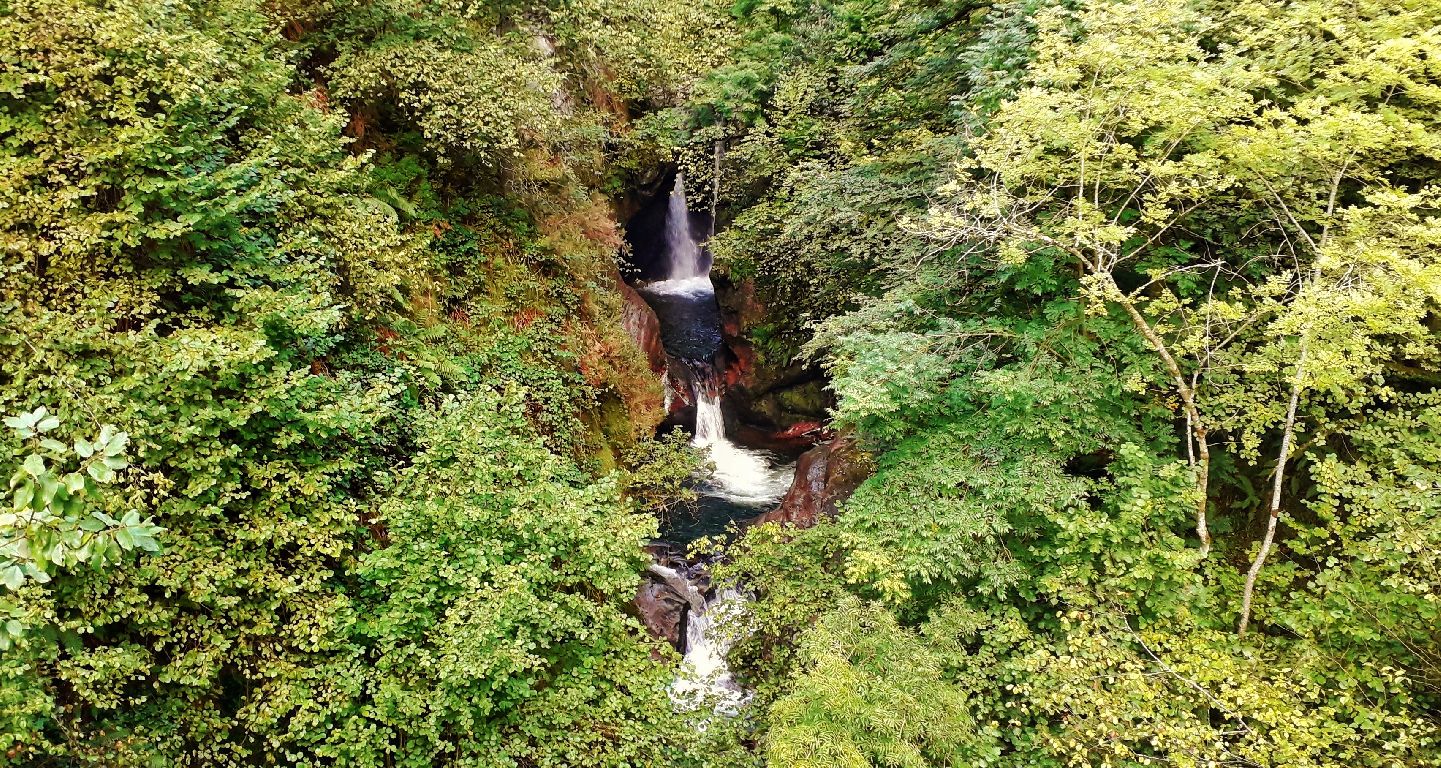
 POZO DEL AMO POZO DEL AMO
Going up through the Palombera mountain pass via the CA-280, a green sign will indicate one of the most beautiful places on the road: Pozo del Amo. The Saja River falls along the rocks creating a series of waterfalls. What makes this place so special is the lush vegetation that surrounds it, as well as the roar of the water as it falls.
 Be careful when you go to see it because it’s on a curve and there’s nowhere to park. If you want to take a photo, up ahead is the Jaya Cruzá parking lot. You can leave your car here and carefully return to the waterfalls. Be careful when you go to see it because it’s on a curve and there’s nowhere to park. If you want to take a photo, up ahead is the Jaya Cruzá parking lot. You can leave your car here and carefully return to the waterfalls.
 LA CANAL DE CUREÑAS ROUTE LA CANAL DE CUREÑAS ROUTE
All good things require effort, and the Canal de Cureñas Route is no exception. It’s one of the classic trails in the region, but it requires you to be fit. It’s just over 18 kilometers long and has an incline of 870 meters. But what’s so special about it? We’ll tell you right now:
- Natural environment: it’s within a natural park. The uneven terrain all around allows you to see different vegetation as you climb higher. If you’re quiet and observant, you may be able to spot animals that live in this natural paradise.
- Geology: halfway through there are some castle-like rock formations to the left called the Molinucos del Diablo. The route ends at Cantos de la Borrica, where there are large masses of stone with glacial origins.
- Megalithism: close to Cantos de la Borrica you’ll find the Sejos – Cuquillo megalithic area. Spread out throughout 2.5 kilometers you can see large menhirs, mounds and circular structures with slabs of rocks. This place is truly a marvel and the most significant megalithic complex in Cantabria.
- Tradition: in Cantos there are some of the cabins that shepherds used to take care of the cattle during the summer.
Now, if we’ve convinced you to do the route, we’ll give you some details about it. The starting point is kilometer 25 of the CA-280. You have to leave your car in the parking lot signposted as Jaya Cruzá. To the right is the trail where you’ll begin your journey. Right away you’ll see a beech tree with a curved trunk next to the path. It’s known as the crossed beech, or “la Jaya Cruzá.” Then, you’ll reach the Tramborríos area, which is where the Bijoz and Cureñas Rivers meet. From this point on, it’s called the Saja River. You’ll then go uphill for several kilometers through a forest of Sessile oaks. To your right there are some castle-shaped rocks called the Molinucos del Diablo. Next, there’s a conical mountain known as the Cueto de la Concilla. And at the end, the Sejos mountain pastures, along with Cantos de la Borrica and the menhirs. You return using the same path.
Technical information and recommendations:
? Starts and ends: Jaya Cruzá parking. Km 25 road CA-280
? Length: 19 km
? Duration: 7 h
? Level: moderate
? Type of track: linear
? Incline: +920 m./ -920 m.
? Type of path: walking path
? Signpost: parcial.
? Drinking water: no
Notes:
- We recommend downloading the track of the route on your phone.
- Wear good hiking shoes and take a walking stick.
- Check the weather forecast beforehand. If there’s bad weather, it’s best to leave it for another day.
- Only leave your footprints on the ground: throw any trash you accumulate into the correct bin when you return.
- Live in harmony with the environment: observe animals from a distance and respect the plants. If you walk quietly you may find some pleasant surprises.
Download more information and track HERE
 BALCÓN DE LA CARDOSA VIEWPOINT BALCÓN DE LA CARDOSA VIEWPOINT
The Palombera mountain pass is the perfect scenic route for you to enjoy either on foot, by bicycle, motorbike or car. After passing a spectacular beech forest, you’ll reach some pastures. Be careful with the inhabitants of the commonwealth, especially in the summer when there are many cows and horses. It’s very important that you respect them, as we’re the outsiders here!
Along the CA-280, at a height of about 100 meters, is the Balcón de la Cardosa viewpoint. It’s north-facing and a truly breathtaking sight. You’ll notice that you’re not alone...the deer statue welcomes everyone who visits because it’s the perfect spot for a photo!
 It’s an experience we recommend in the summer, as it’s incredible to sit in silence just listening to the bells of the cows and horses. It’s an experience we recommend in the summer, as it’s incredible to sit in silence just listening to the bells of the cows and horses.
And if you come in September during deer rutting season, it’s a great place to hear the bellowing across the whole valley.
|
|