Cabezón de la Sal
 Download the information and go!
|
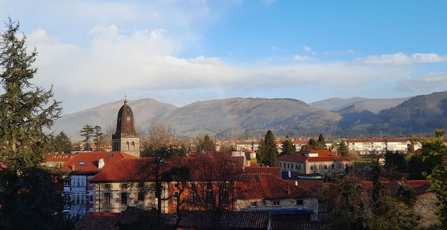
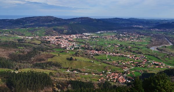
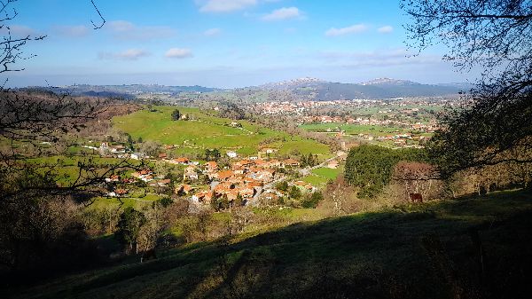
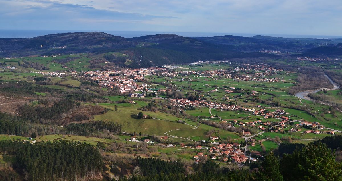
The Saja River shapes the terrain as it passes and forms valleys, and it’s in one of these where we can find the municipality Cabezón de la Sal. To start with, here are the towns that it consists of: Bustablado, Cabezón de la Sal, Carrejo, Casar de Periedo, Duña, Ontoria, Santibáñez, Vernejo and Virgen de la Peña. As a brief introduction to the municipality, you should know that the majority of the population can be found in its capital: the town Cabezón de la Sal. It’s a town of great importance to the area, due to its location, as well as its commercial, administrative and economic activity, especially due to its prominence in the textile industry. The name Cabezón comes from the word “cabezo” which is the word used to describe cone-shaped hills. In this case, the hill is called Picu La Torre and it can be found at the entrance of the town. The second part of the name comes from Salt, a very precious resource used for food preservation and leather tanning. The salt was extracted from the mines, which despite being closed today, still leave their mark in the municipality’s name and architecture, as parts of buildings have disappeared due to the method used to extract salt. The technique was to put water pressure on the subsoil to dissolve the layered salt. After the layers of salt disappeared, the subsoil was left hollow and empty, thus debilitating the buildings’ foundations and causing them to topple over. Any time of year is perfect to visit, because the municipality of Cabezón de la Sal offers so many things to see: the villages’ traditional mountain or “montañesa” style of architecture, museums like the Nature Museum or the Textile Art Museum, festivals like Cantabria Day or the Bean and Vegetable Festival, the natural environment with the Minchón river path, and of course, the delicious gastronomy. Next we’ll reveal more of its ESSENTIAL information and also clues and fun facts to get to know this municipality a little better.
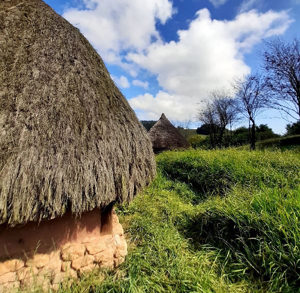
At the entrance of Cabezón de la Sal, on the hill known as Picu La Torre, is where our journey back in time begins… We’re going to be able to experience the Cantabrian way of life in the Pre-Roman period. The town is a replica of what could have been a Cantabrian fort from 2000 years ago. We’ll see its defensive wall, houses, clothing, weapons and we’ll learn about the customs.
Do you want to know what it’s like to walk among trees that are over 36 meters tall? Come to the sequoia forest and connect with this species that originates from North America. So you may be wondering, what are they doing here? Well, this plantation was created for its timber use in the 1940s; however, in the end it was decided not to chop down these beautiful trees, and now we can enjoy this spectacular forest which has been declared a Natural Monument. There are over 840 specimens of the Sequoia sempervirens species, also known as the coastal redwood or California redwood. The forest’s main entrance is through a wooden walkway.
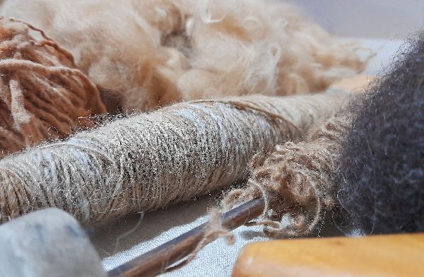
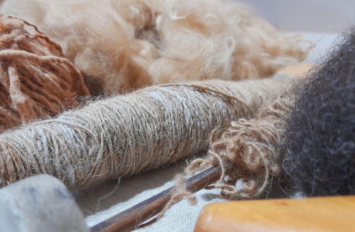
The textile industry has proved to be of great economic importance in Cabezón. Many of its inhabitants have worked, or continue to work, at the textile company, Textil Santanderina, or more commonly known by locals as La Fabricona. So this museum is well-deserved and it’s where you can see the entire manufacturing process, from its raw materials to the finished piece. Furthermore, on the top floor there’s a display of the traditional Regional Costumes. You can see the different outfits that are used depending on the occasion and geographical area from which they come.
At the Los Haces Palace in Carrejo, a building from the 18th century, you can find the Nature Museum of Cantabria. If there’s anything that sets our little region apart from others, it’s its natural environment, and it’s here where you’ll have the chance to learn about it in more detail. Through maps, models, fossils, taxidermy animals, etc., you’ll experience its 5 ecosystems, geology, flora, and fauna. You’ll also be able to listen to the sounds of different birds.
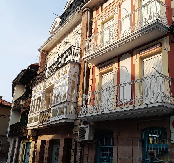
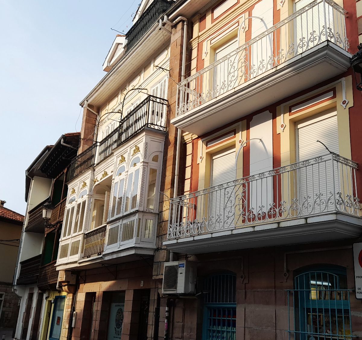
The best way to get to know a place is to wander around through the towns. The self-guided tours on Cabezón de la Sal’s website will help you take a look in the past through its architecture. We’ll leave you with each of the links for quick access. ► Self - guided tour Cabezón de la Sal ► Self - guided tour Santibáñez - Carrejo ► Self - guided tour Casar de Periedo
There’s no better way to complement a tourist visit than trying products from the region. Although they’re not exclusive to the municipality, blood sausage, beans, and tudanca cow meat are fairly relevant in the area.
This trail promises incredible views, weather permitting. Climb to the top of one of the most unique mountains in the area: the Sierra del Escudo de Cabuérniga. There are two lookout points which indicate exactly what you’re looking at: Piralba and Cantos Redondos Lookout Points. There are 360º panoramic views of: the Picos de Europa (the Peaks of Europe) and the Sierra del Cuera; the Cantabrian Mountain Range; the Valley of Cabuérniga; the Eastern mountains of Cantabria; the municipalities of Cabezón de la Sal and Mazcuerras; and the whole coast from the limit with Asturias to close to Santander. It’s a truly amazing sight to see! Technical information and recommendations: Notes:
The El Minchón river path is an easy route and suitable for anyone. It starts in the town of Carrejo next to the water mill, and goes along the left side of the Saja River to the town of Ontoria. Throughout the route you can see harvesting fields, riverbank vegetation with willows and alder trees, indigenous vegetation like oak and chestnut trees, and if you look south, you’ll see the Sierra del Escudo de Cabuérniga mountain range. Halfway through you’ll come across a footbridge that connects the municipalities Cabezón de la Sal and Mazcuerras. We recommend you go up and enjoy the views that both sides of the river have to offer. Look carefully to see if you can spot any river inhabitants: grey herons, mallards, and trout! The journey continues to Ontoria, which is the end of the trail. Now all you have to do is return to Carrejo on the same path or through Cabezón de la Sal. A tip: if it’s summertime, take your swimsuit and towel and take a dip in the river! Technical information and recommendations: ► Starts and ends: Carrejo / Ontoria Notes:
|

 POBLADO CÁNTABRO (A CANTABRIAN SETTLEMENT)
 On your visit, you’ll learn about weapons like the “falcata” and “caetra,” and what other objects like a “torque” and a “fíbula” are and what they were used for. You’ll also learn how grinding was carried out using a barquiform mill.
 THE SEQUOIA FOREST
 A sequoia’s bark is just like our own skin. You’ll see how some trees have been damaged by visitors who take pieces of the tree with them. Please help us conserve them. Instead, take a photo with them so you can remember the experience of visiting a sequoia forest.
 Visit the Cabezón de la Sal tourist office for hours and tours. Telephone: 942 700 332
 NATURE MUSEUM OF CANTABRIA
 SELF-GUIDED TOURS: CABEZÓN DE LA SAL, CARREJO-SANTIBÁÑEZ, CASAR DE PERIEDO
 TASTE THE FLAVORS OF THE AREA