Mazcuerras
 Download the cheat sheet and go!
|
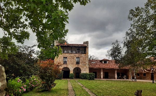
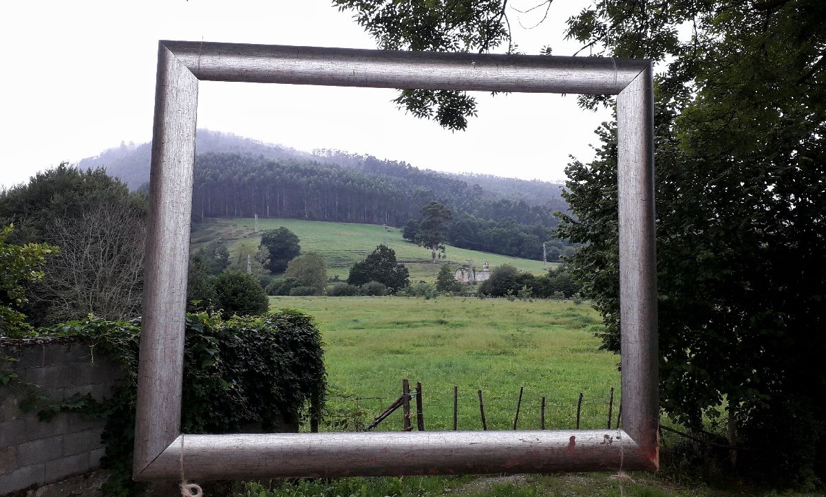
The municipality of Mazcuerras is located in the valley of the Saja River, and it’s surrounded by the Ibio and Mozagro mountains and the Sierra del Escudo de Cabuérniga, among others. It’s made up of the towns: Cos, Herrera de Ibio, Mazcuerras, Riaño de Ibio, Sierra de Ibio, and Villanueva de la Peña. Due to its strategic location and fertile land, Mazcuerras has been inhabited since Prehistoric times; a fact proven by a piece of flint found in Ibio. The Romans later used the valley as a secondary route to connect the Meseta with the coast. There are some stand-out buildings from the Middle Ages like the Tresileja necropolis which dates back to the 8th century which was discovered in 1990 next to Santiago church in Cos, and Cintul Hermitage from the 12th century. However, they cannot be visited nowadays. After the retreat of the Muslims in the 9th century, the repopulation of Castile began. People from these and other lands, began a movement known as “The Route of the Foramontanos.” Its villages are living history, and a place where you can travel back in time and see the evolution of the traditional montañesa architecture from the 16th to 19th centuries. Architecture that began with the one-story flat house; next, the loft house, with a ground floor and a small loft above; then come the large houses, towers, baroque mansions and the buildings of the Indianos in the 19th century. Next, we’ll unveil the places we recommend you visit:
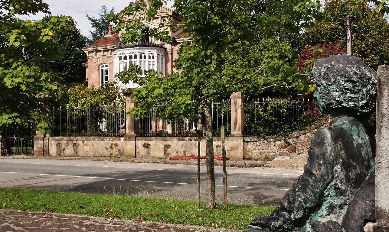
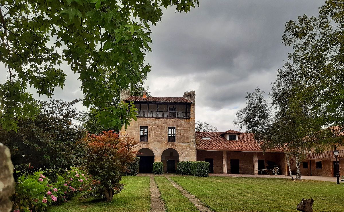
Mazcuerras is a town of architecture and letters. In 2008 it was named “The Most Beautiful Village in Cantabria” and Josefina Aldecoa, a writer who lived here, once called it “her place in the world,” and for a good reason! It has a mix of 15thcentury architecture with the Casa Gótica (The Gothic House), baroque mansions like the Rivero-Gutiérrez House and buildings from the 19th century like Las Magnolias Mansion. All of this is seasoned with contemporary touches like sculptures and photographs from the Aselart exposition. If you visit in the summer, you may even watch a traditional bowling match which is typical in many villages in the area.
We know that Cos has a medieval origen because a cemetery was found next to the church. This burial ground is known as Tresileja Necropolis and it dates back to the 8th century! Although it cannot be visited today, it’s still an interesting fact. If you decide to talk a walk through Cos, you’ll notice that some of its streets are lined with rowhouses, which generally face south-southeast to take advantage of the sunlight. There are also 16th century buildings like the Cos family tower-house, the flat houses and the loft houses. From the 19th century, you’ll see the Quinta Rivero House. Its architecture and exotic garden hint at the fact that its owner was an Indiano, a Spaniard who became wealthy in America.
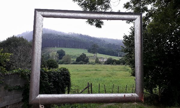
One of the reference mountains in the area is Mount Ibio. The views from its highest point are amazing! Of course, the weather needs to be nice to experience it in all its glory. You need to go to the neighboring municipality of Cartes in order to reach the Alto de San Cipriano. The ascent has an incline of 510 meters spread out over 6 kilometers.
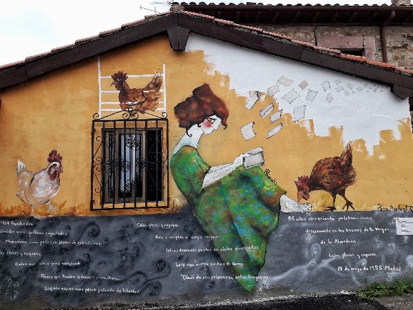
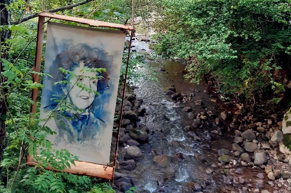
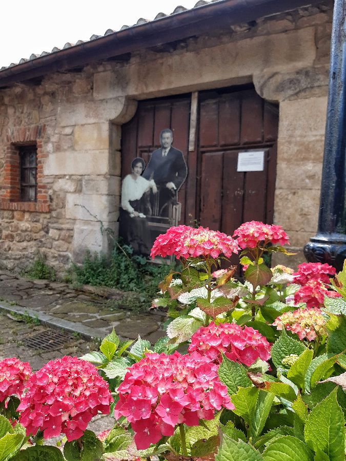
Art is the medium we, as human beings, use to express our feelings, emotions and perceptions. Since 2015, art has been embedded in Mazacuerras’ streets and landscape. The neighbors use their properties to exhibit all types of art like photographs, sculptures, and music. The first year of the exhibition, the neighbors displayed their sculptures high above the ground, similar to when the chickens would “aselar” in the evening, or in other words, perch themselves in high places to rest or sleep. That’s how the annual summer exhibition—in which everyone comes together to give the town an artistic touch—received the name Aselart.
If you’re looking for a place to eat, play or take a walk, we recommend the El Bosque recreational area. It’s located next to the Saja River and can be accessed through Mazcuerras. It’s got picnic areas and two football goalposts, and it’s the perfect place to enjoy the natural environment. Do you feel like taking an easy stroll on flat terrain? Take the path to the left of the recreational area which takes you to the riverbank. If you continue on this path, about 700 meters ahead, you’ll find a bridge over the Saja River. If you cross the footbridge, you can connect with the Minchón river path, in the neighboring municipality of Cabezón de la Sal. If you decide not to cross and continue straight ahead, you’ll reach the town of Cos.
The route sets out from Herrera de Ibio. At the end of the town (look toward the mountain as a reference point) there’s a track that has signs towards Braña de Silla Oso. There’s also a sign for a restaurant that could be useful. Once you pass said restaurant, you’ll see some other houses. There are several different paths here. Take the one furthest to the left and you’ll soon reach the Refugio de Silla Oso, a stone cabin-like shelter. The trail can be done on foot and on mountain bike. Technical information and recommendations: ► Starts and ends: Herrera de Ibio Notes: 1. We recommend downloading the track of the route on your phone.
The locals more commonly refer to it as the climb to Cos pole. It’s not necessarily a pole, but an antenna located at the summit of the Gamonal area. The trail begins in Cos and you follow the road to Venta de Santa Lucía (Santa Lucía Inn). This building was a resting spot of cart drivers and walkers who were going or coming from other areas. The path you should take is just to the left of the inn. A few meters away starts the uphill climb which leads you to the pole, where you can see amazing panoramic views of the valley and the mountains. Of course, you might not be alone, as you may come across cows or horses grazing or in the stables. Please respect them: this is their territory. Follow the path on the left to go back down to Cos. Technical information and recommendations: ► Starts and ends: Cos Notes: 1. We recommend downloading the track of the route on your phone and check the weather forecast beforehand.
If you’re not in good enough shape to go on hiking trails with an incline, you can take a walk throughout the municipality. The flat terrain and the pedestrian lane along the main road allow you to easily visit all the villages. You set off from Cos, pass through Mazcuerras towards Herrera, Ibio, Sierra and Riaño, and end up in Villanueva de la Peña. To return to Cos, you can take the road that goes along the meadows. |

 A VISIT TO MAZCUERRAS
 If you want to learn more about Mazcuerras, click on the link
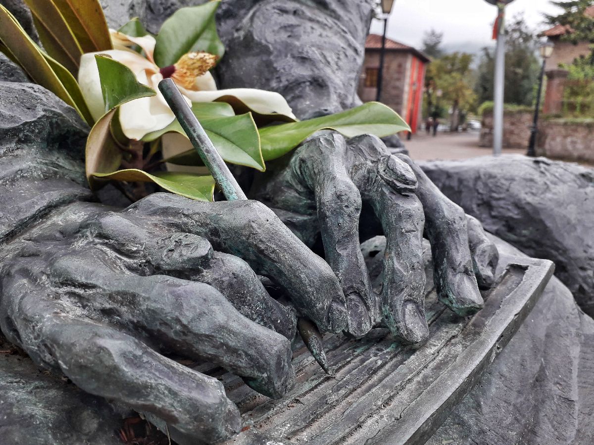
  On the library wall and in front of Las Magnolias Mansion, you’ll see two sculptures that represent a musician and a writer. You’ll have to guess who they are!
 MOUNT IBIO
 EL BOSQUE RECREATIONAL AREA


