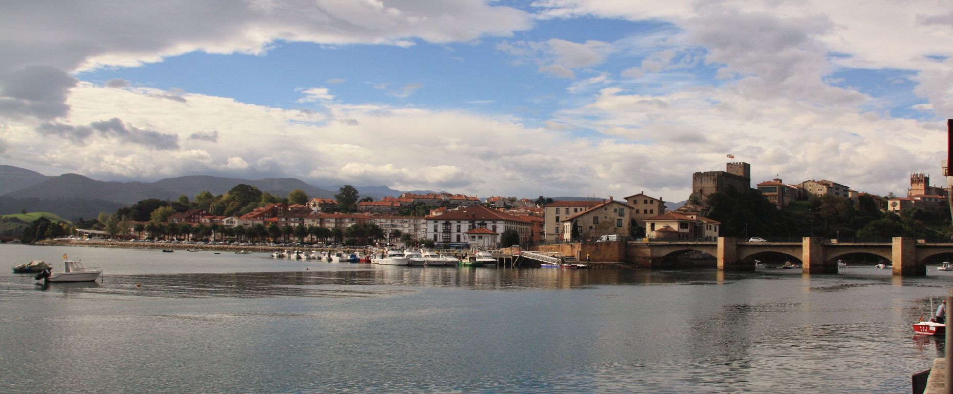
San Vicente de la Barquera
 Download the cheat sheet and go!
|
In the privileged environment of Oyambre Natural Park, we find the municipality of San Vicente de la Barquera. Let’s start with the towns that make up this municipality: Abaño, La Acebosa, El Barcenal, Gandarilla, El Hortigal, Los Llaos, La Revilla, Santillán-Boria and San Vicente de la Barquera. As a brief introduction, it’s important to note that due to its strategic position next to the Cantabrian Sea, the capital, San Vicente de la Barquera, has played a very important role in the history of our region. Maritime trade has been a fundamental part in the town’s development. During the Roman Empire it was known as the port of Vereasueca, although its greatest growth came in 1210 when King Alfonso VIII created a municipal charter. This involved a series of benefits and tax exemptions for its economic development. At the same time, the salt trade was regulated, which increased its fishing activity since salting was one of the most popular ways of preserving fish. Nowadays, it’s still a model fishing port. Countless travelers transited through this area, one of the most predominant of which being Emperor Carlos V when he was still a prince and heading towards Castilian lands to be crowned as Carlos I. That is how San Vicente became part of the European Routes of Emperor Carlos V. The routes of the pilgrimage have become one of many of the historical paths that cross the municipality of San Vicente. The Northern Camino de Santiago (the Way of St. James) and the Camino Lebaniego bring thousands of pilgrims from all over the world. Next we’ll reveal more of its ESSENTIALS:
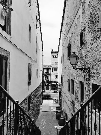
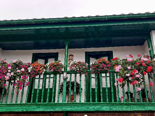
Much like a natural moat, the Pombo and Rubín Marshes surround the peninsula where the old town is located. Like any place with a defensive purpose, it’s located on high ground, so that means you’re going to have to climb uphill! But the views are well worth the effort. On Calle Alta, formerly known as Rúa Mayor, we can see these main monuments:
The Punta de la Silla Lighthouse has been the guiding light for sailors since 1871; it’s also home to the Oyambre Natural Park Research Center. The natural parks are spaces created to protect the flora and fauna. In Oyambre’s case, its size is around 6000ha (about 6000 football fields) and it’s divided into different areas: the coast, with its cliffs, beaches and estuaries; the meadows; and the forest, like Monte Corona. In the rooms of the lighthouse, there are materials on display which allow you to gain a better understanding of the park. But best of all, you can take in all this information live just by looking out the windows.
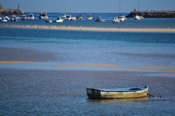
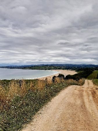
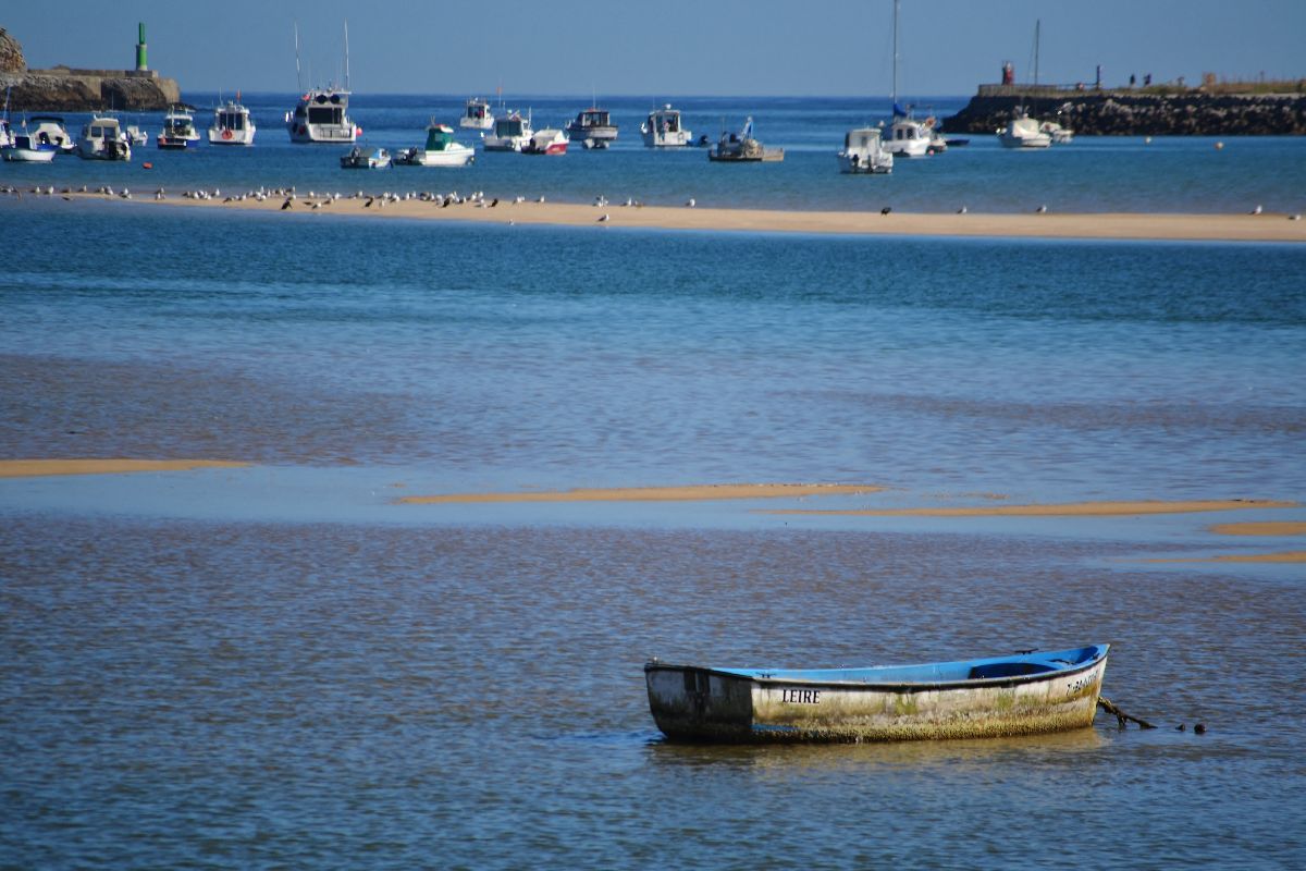
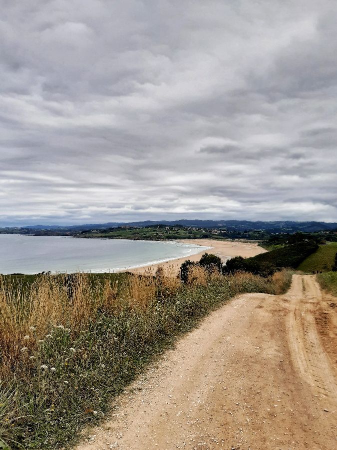
If there’s anything that represents the municipality, it’s the beaches. There’s something for everyone: big ones, small ones, coves, those that give way to the open sea, or those that are sheltered in an estuary. Depending on who you ask, they will give you a different name because the beaches are also known by some of their special features. Here we’ll explain:
They’re the ideal places to enjoy yourself by swimming, sunbathing, going for a walk or practicing water sports like surfing, paddleboarding, rowing, fishing or sailing.
Along the whole coast, from Los Llaos to Boria-Santillán, you can enjoy one of the most beautiful sunsets. We recommend two locations:
Every time the tide rises and falls, we see a different landscape. That’s the magic of nature! Each day there are two high tides and two low tides. Between two high tides, there are approximately 12 hours and 25 minutes. And between a high and low tide, there are approximately 6 hours, 12 minutes and 30 seconds. Therefore, each day it occurs at a different time. What causes this fluctuation in the water? The Sun and the Moon are responsible. There are two types of tides produced: spring tides and neap tides. They’re known for their intensity and they depend on the lunar phase, as well as the sun and moon’s position with respect to Earth.
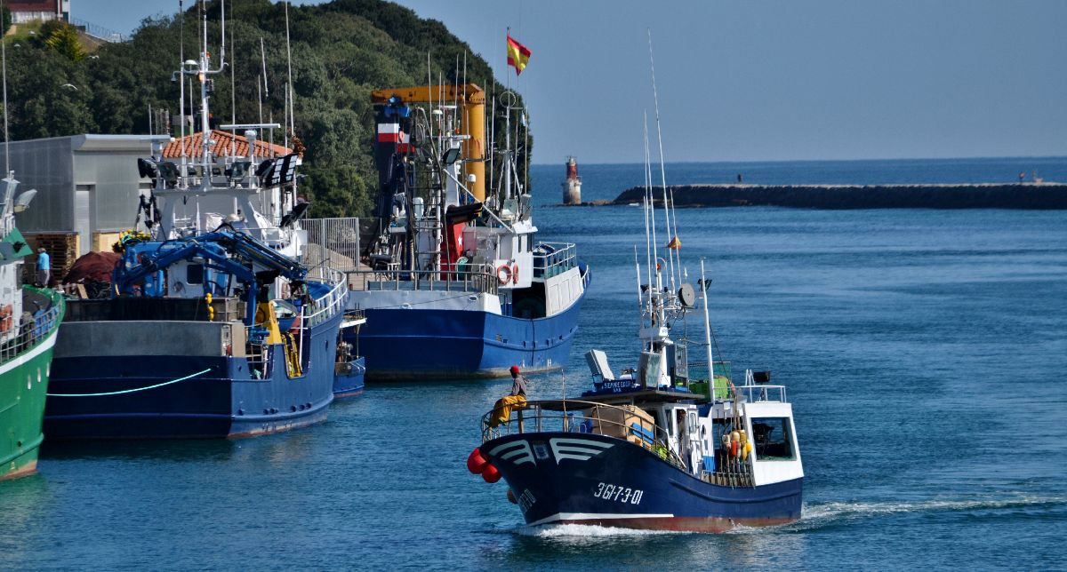
Gastronomy is a fundamental part of getting to know a place since it’s linked to the economy. Because there’s a mix of sea ports and farming in San Vicente, surf and turf platters are a great option. The fresh fish that arrives at the market and shellfish are essential culinary staples. And, of course, we can’t forget about our delicacies: squid and a good pot of sorropotún—a quintessential seafood dish. It’s similar to what in other regions is known as ‘marmitako’. Sorropotún is a stew made up of tuna, potatoes, onions, green peppers, tomatoes, stale bread, water, salt, olive oil, and a pinch of love and patience. When it comes to sweets, we’ve got Pejinas. Besides getting its name from what the women of San Vicente are called, it’s a sweet puff pastry filled with “cabello de ángel” (or “angel hair”—a candied filling made from squash). Come try them!
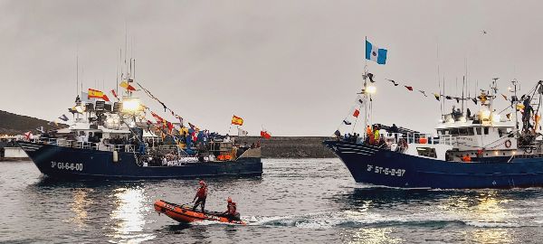
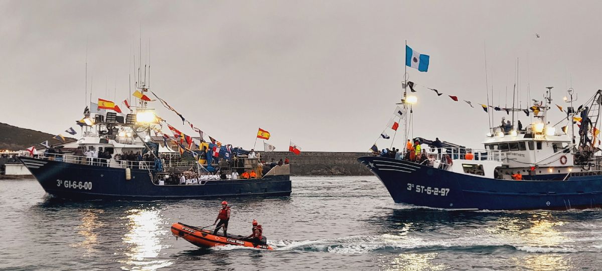
Another experience we recommend, is to walk through the port or watch its activity from La Barquera Bridge. Every time the boats arrive, there’s a bustle on the dock to unload the fish and other tasks, including the repair of fishing nets. This job is done by ‘rederas,’ women in charge of sewing the nets that have broken throughout the day on the fishing boats. Watching the skill and speed with which they sew is worth the walk. But of course, this isn’t something we can always see on the dock.
Come see some of the incredible views in San Vicente. Here are a few suggestions:
? THE CLIFFS OF SAN VICENTE Walk along the cliffs that go from the lighthouse to Fuentes Beach. The trail is about 9km and has little incline. Halfway through the hike you should look for the cave where the Cúlebre (a mythological winged serpent-dragon) lives.
? PÁJARO AMARILLO (YELLOW BIRD) Setting off from San Vicente, go along the coast to reach Oyambre Beach. The cliffs, beaches and the story of the Yellow Bird are some of the highlights of this 13-kilometer trail. And of course, you’ll have to pay attention to the tides!
|


 OYAMBRE NATURAL PARK RESEARCH CENTER
 Within the center’s outdoor enclosure,
 THE BEACHES
 A SUNSET: IN SEARCH OF THE GREEN RAY
 THE RISE AND FALL OF THE TIDES
 PRODUCTS FROM THE SEA
 FISHERMEN AND


