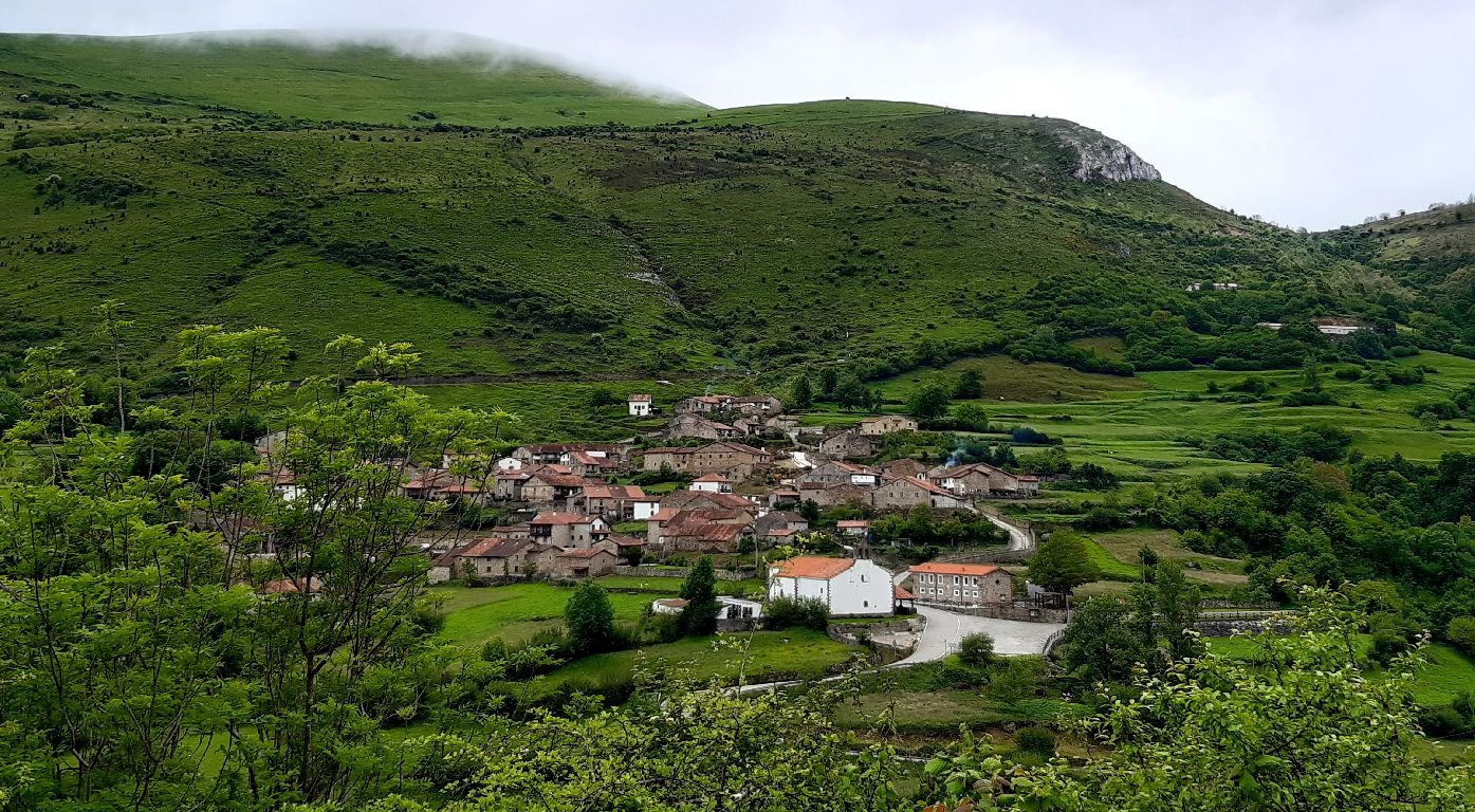
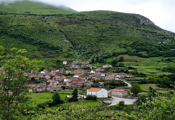
Tudanca
 Download the cheat sheet and go!
|
After passing through Polaciones and the La Cohilla Reservoir, the Nansa River runs through the municipality of Tudanca. This municipality is tucked away by the Estrecho de Peña Bejo (also known as Caos de Bejo), but opens up when you get a bit further down. Within the territory of Tudanca are the villages: La Lastra, Santotis, Sarceda and Tudanca. It’s a municipality where you can find a nice mix of well-preserved traditions, hiking trails, literature and architecture. Doesn’t that sound wonderful? Let’s start with its name: Tudanca. If you spend a few days in the region, you’ll see some slim, greyish-black (they’re sometimes brown, as well) cows grazing. They are Tudanca cows, a native breed of Cantabria. This breed is adapted to mountain areas where they regularly graze from May to October. In the past, they were used for working on the fields, but nowadays, their beef is a valuable resource in the area’s cuisine. An interesting thing about Tudanca cows is that they’re born a reddish-brown color and as they grow, they turn grey and black. Their snout and the area around the eyes are white and they have large, curved, white horns with a black tip. The males are black and have a white stripe that goes along their back. José María de Cossío, who we’ll talk more about later, once said they were “strong, agile, calm and resilient” cows; we’d also add that they’re peaceful and very intelligent. Tudanca was a passage on historic routes that connected the coast and the meseta, like El Potro Trail and the Camino Real. It might be a challenge getting to know the area on foot, and judging by the mountains that surround us, you can imagine it won’t be an easy task! However, if you prefer something more relaxing with less effort, a walk through town and a visit to the Tudanca House is the perfect plan, too. Now, we’ll reveal more details about the ESSENTIAL places you need to EXPLORE, and interesting facts that will make your visit more fun.
Did you know that Unamuno and Alberti, among other prominent people, walked though the streets of this village? Keep reading and you’ll find out why. In 1983, Tudanca was declared part of the Historic-Artistic Grouping due to its excellent preservation of its traditional ‘montañes’ architecture. The streets have a mix of large 18th century houses belonging to those who emigrated to America, and more modest houses lined in rows which adapt to the steepness of the terrain. It’s a must-see sight in the Saja Nansa region.
On the CA – 281 road, right next to the bus stop, is the Santotis lookout. From here you can see almost all of Tudanca, except Sarceda, which is hidden about 4 kilometers north. You can see the villages of Tudanca and La Lastra, the Estrecho de Bejo, Prao Concejo and the hills of El Haya and La Avellanosa. It’s a place with STUNNING views!
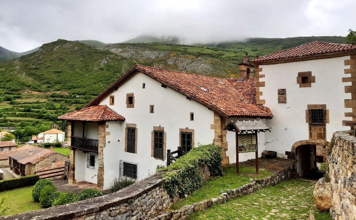
Visiting la Casona gives you the opportunity to see what an 18th century house was like. It was built on the orders of an emigrant who went to Peru; and one of its owners was José María de Cossío, philologist, essayist, author of the bull-fighting encyclopedia El Cossío and member of the Spanish Royal Academy. He had a close relationship with writers from the Generation of ‘27, bullfighters and footballers. Many people visited la Casona and left their mark, including José María de Pereda, Carlos Gardel, Unamuno and Alberti. They considered it to be “a refuge of Spanish culture among the mountains.” Tudanca even appears in literary works like Pereda’s Peñas Arriba, in which it has the fictitious name of Tablanca.
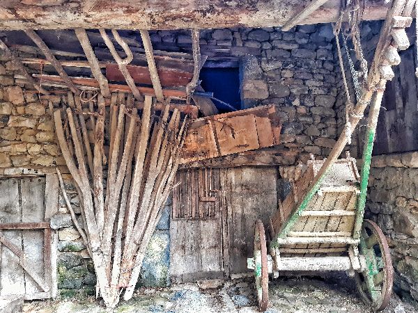
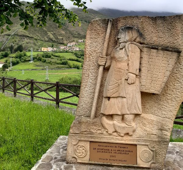
Tudanca has been closely linked to livestock. Atop the mountain where Tudanca is located, you’ll find Prao Concejo, which has been a communal meadow since ancient times. For its use and maintenance, it’s divided into 8 areas, which are in turn divided up into smaller areas. They are then allotted to residents to use for harvesting. In the spring it’s used for grazing or as what is commonly said, it’s gathered “a diente” (or in other words, “by mouth” by the cattle). Unamuno defined it as “a model of collective agrarian use” and this is how it’s reflected in his writings. Some typical harvesting expressions in Tudanca are:
The waters of the Nansa River have been used to move mills, make the iron foundry run, and to move turbines to produce electricity in the 20th century. It is one of the rivers that has been most modified by the hand of man with the construction of reservoirs, diversion dams and falls like the one in La Lastra which started to function in 1947. If you go up towards Polaciones, a little above La Lastra, you’ll see a large pipe that passes over the road. It’s a penstock that takes water from the La Cohilla reservoir to make it fall hard and move the turbine to produce electricity. The excess water falls into the counter-reservoir of the La Lastra plant. This means of electricity production is called a fall.
The road that goes from Tudanca to Polaciones winds its way up through the Estrecho de Peña Bejo (also known as Caos de Bejo), a mountain excavated by the Nansa River looking for its outlet to the sea. Its walls are a hidden gem from a geological standpoint. In them, you can see the best set of geological matter in Cantabria from the Triassic period 250 million years ago.
In Tudanca, we suggest you follow the routes that were used for centuries to connect the coast and the Castellana plateau. They do, however, require some physical fitness due to their incline. The first one, El Potro Trail, has the description starting from Polaciones to Tudanca, so you’ll have to read it starting from the end!
This trail is part of the route that connected the coast with the Castilian meseta. There are several alternatives depending on the place you choose to start from. We recommend connecting the municipalities of Polaciones and Tudanca by starting in Pejanda and finishing in Tudanca, or viceversa. It’s a linear route and given its length and incline, we recommend taking two cars and leaving one at each point. From Pejanda, follow the road to Callecedo, where you take the path that goes to the left towards Peña Sagra. You’ll climb uphill for 6 kilometers until you reach El Potro lookout point where your mouth will probably drop once you see the amazing panoramic views of La Cohilla Reservoir, Tudanca and mountains like La Concilla, Peña Labra and Tres Mares Peak. The trail then goes downhill to a junction called Collado de Abeyán (it’s also known as “Joza Abellán” or “Jozalabellán”). It forks into two paths that lead to San Sebastián de Garabadal and La Lastra. To continue the trail, take the path to La Lastra and from there, Tudanca. Technical information and recommendations: ► Starts and ends: Pejanda - Tudanca Notes: 1. We recommend downloading the track of the route on your phone and check the weather forecast beforehand.
This trail follows the route of the Camino Real, which connected San Vicente de la Barquera with Medina de Rioseco and Toledo. It requires you to be physically fit due to the steepness of the terrain. The route starts in Tudanca so you should leave your car in the parking lot at the entrance of the town. You go up to the highest part of the village and then, to the right if you’re facing south, you’ll take a concrete path. This will take you to the Santuco de Hoz where the trail starts to go downhill. The ‘santucos’ are small shrines with religious imagery that are set along the main roads. They were a way to protect the walkers’ souls. You’ll come across a fork in the road with a concrete path that leads to the Las Nieves hermitage. If you want you can go see it and return to the fork. However, at the fork in the road, take the path to the right which is a trail that will lead you to the Sobayo cabins. These structures are quite common in cattle areas, as they’re a refuge for the livestock during the cold winters. Once you pass the cabins, leave the path and start to follow the trail next to the ravine. After crossing the river, you’ll see a path with large stone slabs. Continue through El Haya hill until you reach Collado de Pantrieme. From this point on you’ll go downhill until you reach Puente Pumar. Technical information and recommendations: ► Starts and ends: Tudanca - Puente Pumar Notes: 1. We recommend downloading the track of the route on your phone. |

 THE VILLAGE OF TUDANCA
 Pay attention to some small round structures on the second-story of some of the houses: they’re old ovens where cornbread—among other things—was made; the bread is called “borona.”
 SANTOTIS VIEW POINT
 Next to La Avellanosa hill there’s a lot of peat, an accumulation of organic matter that was formed thousands of years ago from decayed vegetation. Peat captures a lot of
  At the lookout point, there’s a panel with information about the municipality.
 CASONA DE TUDANCA (THE GREAT TUDANCA HOUSE)
 PRAO CONCEJO
 This video shows you with music rabel
 INDUSTRIAL ARCHITECTURE
 ESTRECHO DE PEÑA BEJO
