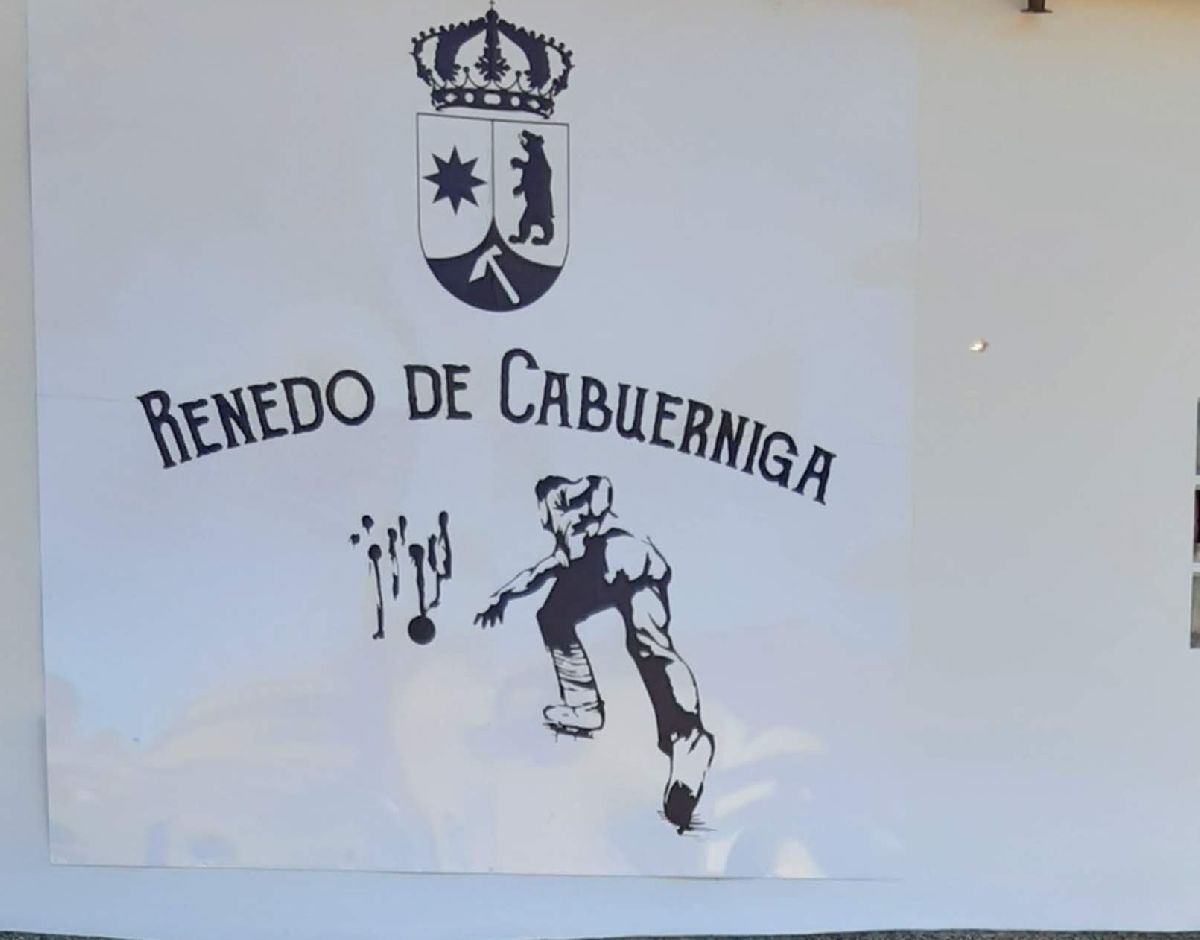
Cabuérniga
 Download the information and go!
|
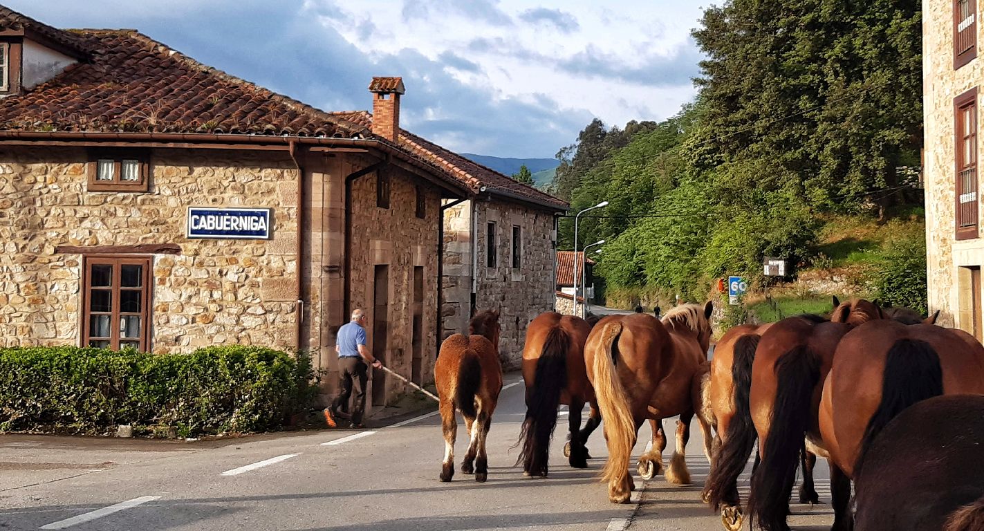
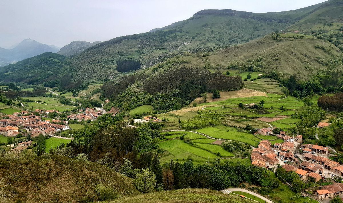
The municipality of Cabuérniga is located in the Saja River valley and includes the village of Carmona, despite being in the neighboring Nansa valley. In Cabuérniga you’ll find a mix of montañesa architecture, amazing gastronomy, a fantastic natural environment and traditions that are still celebrated today. It’s the perfect combination! The villages you should add to your visit are: Carmona, Fresneda, Llendemozó, Renedo, Selores, Sopeña, Terán, Valle and Viaña. As a brief introduction, it’s important to note that this valley was, and still is, one of the stops along the way from the coast to the Castilian meseta. During the 9th century, when it was known as Kaornega, it was a passage for people who were going to repopulate Castile. It was called the Route of the Foramontanos. Centuries later, in 1517, a young prince passed through here on his way to be crowned Carlos I in Mojados (Valladolid). He’d later be known as Emperor Carlos V. The rural landscape has been shaped by man through two of the area’s main activities: agriculture and livestock. The flattest part of the land, which we call “mies” (the fields), is used for grazing and the cultivation of corn and beans. In the highest points you’ll see small individual structures. These are called “invernales,” and they are small stables where livestock is housed when it gets cold. One of the traditions that continues to this day is the act of taking the livestock up to the mountains to graze. It’s a short-distance transhumance. The cows and horses go up to the pastures in the mountains in June and stay there until September or October. Their return do to the valley is celebrated with a parade in which Tudanca cows look their best as they show off their cowbells. In Carmona this festival is called “La Pasá,” while in the valley of Cabuérniga it’s known as “La Campaná.” And we can’t talk about Cabuérniga without mentioning its gastronomy: cocido montañés (montañés stew), corn cakes, tender meat and cheeses among a variety of other dishes, pair perfectly with the landscape. Next we’ll reveal more of its ESSENTIAL information and also clues and fun facts to make your visit this municipality more fun.
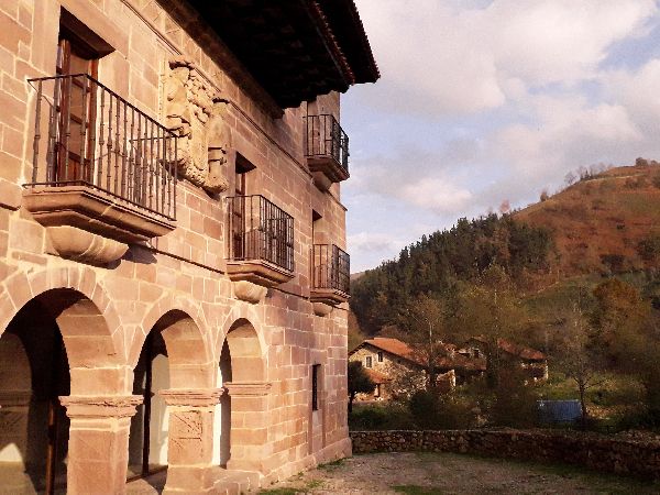
Carmona is a village with titles! It’s known as “The Jewel of the Albarqueros,” it’s been named one of the Most Beautiful Villages in Spain, and it’s part of the Historic-Artistic Grouping. And there’s a reason for all of that. The architecture of the houses is as if straight from a catalog. You can find structures like the one-story flat houses; the loft houses, the mansions from the 17th and 18th centuries, and a unique building in Cantabria: the Rubín de Celis Mansion (also known as Mier Mansion or La Venta de Carmona). The latter’s defining characteristics are the two towers which were inspired by El Madrid de los Austrias (The Madrid of the Austrians).
Both have got BREATHTAKING sights and they are located on the Collada de Carmona (CA-182).
If you like waterfalls and lush forests, this is the trail for you. Your guide on the hike will be the Viaña Stream, tributary of the Saja River. Throughout the course of the river, several waterfalls of various sizes have been formed. You have to reach the end of the route though to see the biggest one: the Pozo del Infierno (Well of Hell). As you walk, you’ll enter the Saja Besaya Natural Park. It’s a beautiful landscape where you’ll see oak trees, a forest along the river and harvest fields. The route starts next to the old watermill in Viaña. From here, you have to cross the stream and continue the course. When you reach a fork in the road, take the path to the right. From this point on, the road becomes a walking path. Along the way there may be wet and flooded areas, so go well equipped with shoes apt for the water and a walking stick. At the end of the trail is the Pozo del Infierno. This last stretch is the most complicated, but it has steps to reach it. To return, you can take the same path back, or another trail that will lead you up to the main road.
Technical information and recommendations: ► Starts and ends: old watermill in Viaña Notes:
Do you feel like walking among centuries-old chestnut trees without going on a long hike? Then come visit Terán. Right next to Santa Eulalia church is La Castañera of Terán, a green area with over 30 live chestnut trees and the remains of some specimens that died years ago. You can complete your visit by taking a walk around Terán, one of the 4 villages in Cabuérniga that’s part of the Historic-Artistic Grouping.
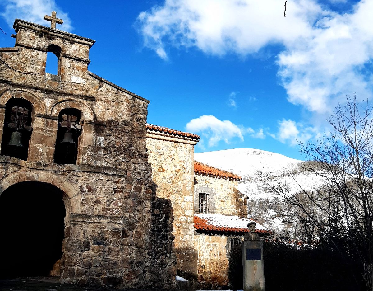
Valle is the capital of the municipality. Just like Renedo, Terán and Carmona, it’s part of the Historic-Artistic Grouping. In the 17th and 18th centuries there was lots of emigration to America. Many people later returned with money to spend in their native villages. That’s the main reason you can find so many baroque mansions in these villages. In Valle, there are some standout houses such as “el cuartel”, the La Fonda rowhouses or the Los Torales House. A tradition that has continued throughout the years in Valle are the livestock fairs on October 22nd and January 15th. Moreover, on the second Sunday in October, there’s a very special festival: La Campaná. The cattle that spent the summer grazing in the mountains, returns to the valley and parade around town looking their best.
Next, we’ll suggest 4 more hiking trails so you can explore the area.
The Saja River Path is an easy route that’s just over 3.5km and mostly on flat terrain so it’s ideal to do with children. If you’re not scared of a little cold water, you can take your swimsuit and towel and go for a dip halfway along the trail in the Pozo Colorao. The route starts in the Sajuca Recreational Area, next to Santa Eulalia church and La Castañera of Terán. The trail begins to the left of the recreational area and it follows the course of the Saja River. At the end of the path, you’ll reach the village of Sopeña. To return to Terán, you’ll have to follow the path that passes along the fields. There’s no shade in this last stretch, so make sure to take something to protect yourself from the sun if it’s a hot day. Technical information and recommendations: ► Starts and ends: Sajuca recreational area. Terán de Cabuérniga Notes:
If you’re a fan of downhill MTB, or you want to do Freeride, Enduro or DH, you have to possibility of doing it in Cabuérniga. The 2.9-kilometer route passes through the forest. You’ll find natural obstacles, curves, bridges and jumps. To reach this point take the CA-182 road to Collada de Carmona. The entrance to the track is at the top of the hill. For more information, follow the link: Downhill MTB Caborzal - Las Viudas
This trail requires some effort due to the steep slope, but the views are well worth the effort. The highest point you’ll reach is the Nuestra Señora de Las Lindes (Our Lady of Las Lindes) Hermitage, a festive place for the people of Carmona. Each year in Carmona there are 2 festivities in August: San Roque on the 16th and Nuestra Señora de Las Lindes held on the following Saturday. The start of the route is Barrio de San Pedro. You’ll have to pass the houses towards the path that leads to Mount Carmona. After crossing the wooded area, you’ll find pastures and the Las Lindes hermitage. You can take the same route to return, or a detour via the CA-182 that will lead you close to Las Riegas Bridge. Technical information and recommendations: ► Starts and ends: Carmona Notes:
Do you want to walk a route that was transited for hundreds of years? This trail is part of the old road to Castile that was still in use until the 19th century. The current road, CA-280 through the Palombera mountain pass, was opened in 1896, thus rendering the old one useless. Many have passed through here, like the Foramontanos in the 9th century, King Carlos V in 1517 when he was still a prince, and hundreds of merchants and mule drivers on their way to the Castilian meseta. The route unites the municipalities of Cabuérniga and Los Tojos. It’s simple, with very little incline and beautiful views. Since it’s linear, you can start in either Llendemozó or Correpoco. Throughout the route, you’ll see the village of Llendemozó, which was practically forgotten for a long period of time and where you can find the San Antonio Hermitage. Its saint is celebrated on August 14th and it’s the perfect time to see its interior: the wooden ceiling is painted with blue, red and yellow flowers and leaves. It’s one of the few that still remain in the area. Shortly before reaching Correpoco, you’ll come across the shrine. The shrines are small structures with religious symbols and they are located along the old paths. They were places where the walkers could pray or figuratively put themselves in the saints’ hands. This shrine in particular is a bit larger than usual because it also served as an “asubiadero.” In Cantabria, “ponerse asubio” means to take shelter in bad weather. Therefore, in this case, its purpose was twofold: it protected the travelers both physically and mentally. Technical information and recommendations: ► Starts and ends: Correpoco / Llendemozó Notes: 1. We recommend downloading the track of the route on your phone.
|

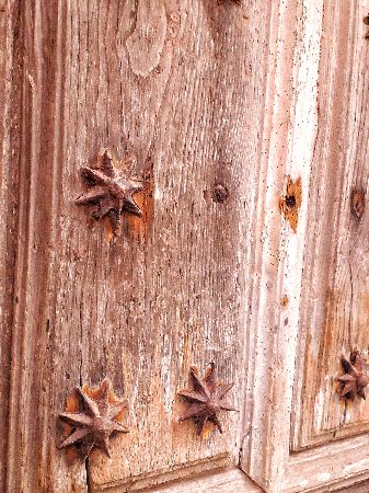
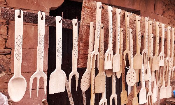
 CARMONA AND BARRIO DE SAN PEDRO
 Albarcas are wooden clogs used to go outside and protect feet from water and humidity. They have a different shape and decorative design depending on the place. There are fewer and fewer “albarqueros” (albarca-makers) in the area, but what you can find if you walk through Carmona, are some artisans making wooden utensils.
 To learn more about Carmona and its history, click on the link from the Esencia de Cantabria website:
 VIAÑA WATERFALLS
 Warning! You need to know that this stream is protected under the
  TERÁN AND LA CASTAÑERA
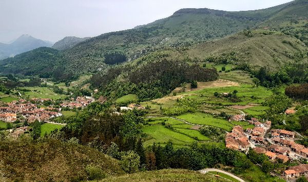
 VALLEY OF CABUÉRNIGA
