Lamasón
 Download the cheat sheet and go!
|
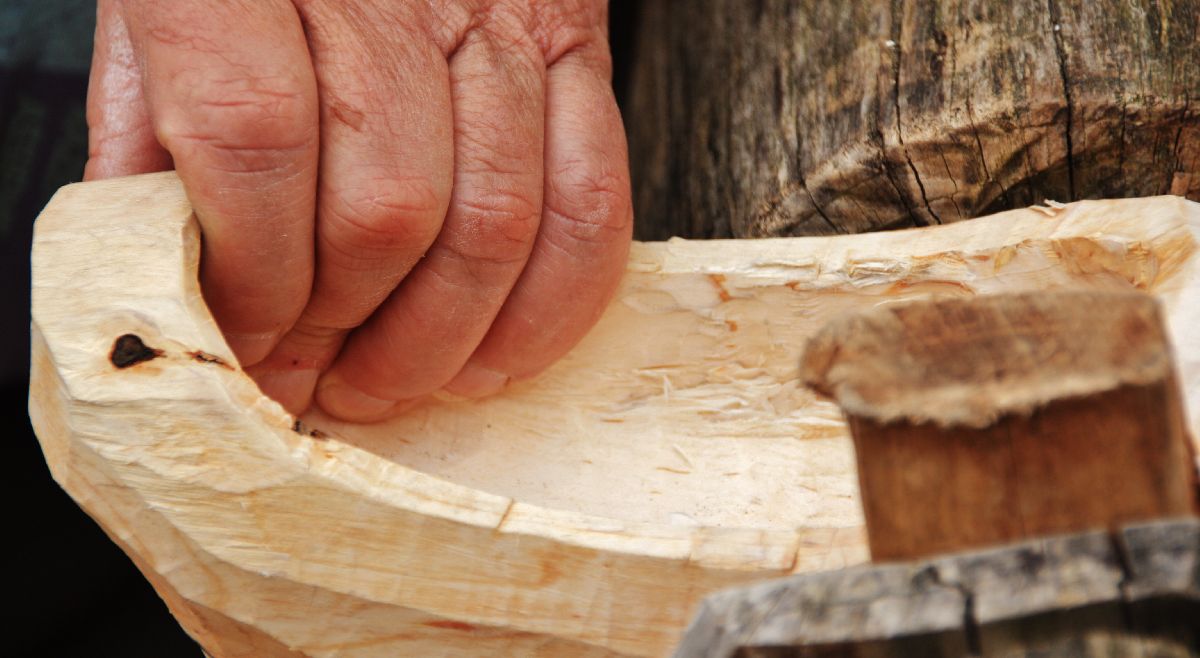
Located between the Deva and Nansa Rivers, the valley of Lamasón is protected by the 4 cardinal points: the Peña Sagra mountains to the south; the Arria massif to the north; the Collado de Ozalba (or Jozalba) to the east; and the Collado de Hoz (or de Joz) to the west. It’s made up of 8 villages: Burió, Cires, Lafuente, Los Pumares, Quintanilla, Río, Sobrelapeña and Venta Fresnedo. The oldest remains in Lamasón can be found in Venta Fresnedo, in Los Marranos cave. In the 1950s, government road workers found signs of Prehistoric settlements in this cave. What was mainly found was portable art like flint chippings and cave art—paintings and engravings—on the walls. The cave isn’t open to the public. The road from Panes to La Hermida was built in the 19th century; Before then, however, the main path that connected the La Hermida gorge with both the Nansa Valley and the coast passed through the municipalities of Lamasón and Peñarrubia. It was a very busy road for walkers, merchants and pilgrims on their way to the Monastery of Santo Toribio de Liébana. Nowadays, this route is known as the Camino Lebaniego. Its landscape is full of meadows and fields with cabins. This shows the link between Lamasón and cattle, especially with Tudanca cows, the native breed of Cantabria. Agriculture was also important in Lamasón: corn, beans and flax were grown. Flour was obtained from corn to make ‘pulientas’ (a type of porridge eaten with milk), ‘tortos’ (a type of small, hard pancake), and ‘borona’ (a type of cornbread). In Lamasón there were almost 30 mills where grinding was done, none of which work today. After giving you a few broad brushstrokes of its history, we’ll reveal more details about the ESSENTIAL things you need to EXPLORE, as well as some interesting facts and recommendations:
It’s not strange to see pilgrims passing through Lamasón; in fact, you may be one of them! That’s because we’re right in the middle of the Camino Lebaniego, one of the first pilgrimage routes with its own credentials. The reason so many people pass through is because they’re trying to reach the Monastery of Santo Toribio de Liébana where the Lignum Crucis—the largest fragment of the True Cross—is located. It’s an Año Jubilar (Holy Year) each time the day of Santo Toribio—April 16th--falls on a Sunday. Within Lamasón, the Camino goes from Venta Fresnedo to Collado de Joz. Come experience what it’s like to be a pilgrim for a day!
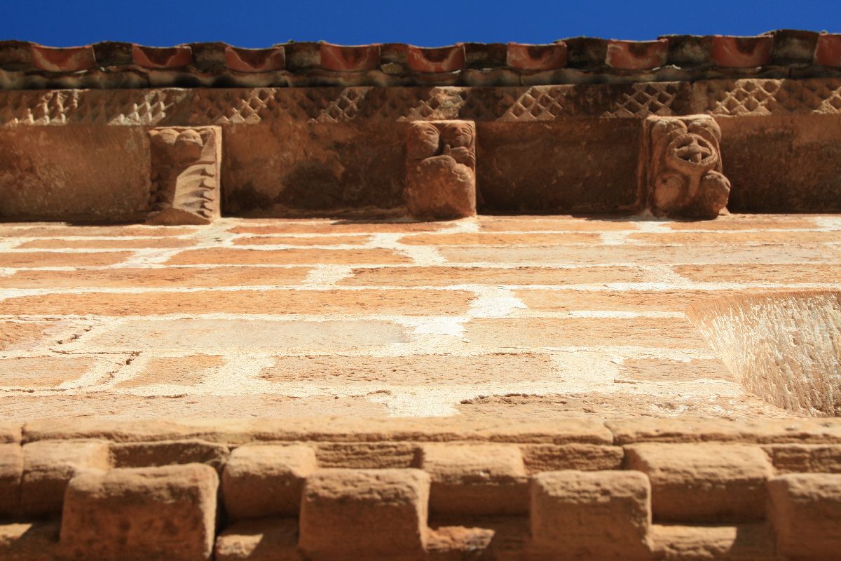
When you reach Lafuente, you’ll see a unique Romanesque structure in the region: Santa Juliana church. It was built in the late 12th or early 13th century. The exterior of the church is decked out in Romanesque elements like corbels (structural pieces of stone the support the eaves), the semi-circular arch and the checkered ‘jaqués’ style details. The latter is a checkered decorative band that goes around the church. The term ‘jaqués’ comes from the cathedral of Jaca and the checkered elements are common of the churches along the Camino de Santiago.
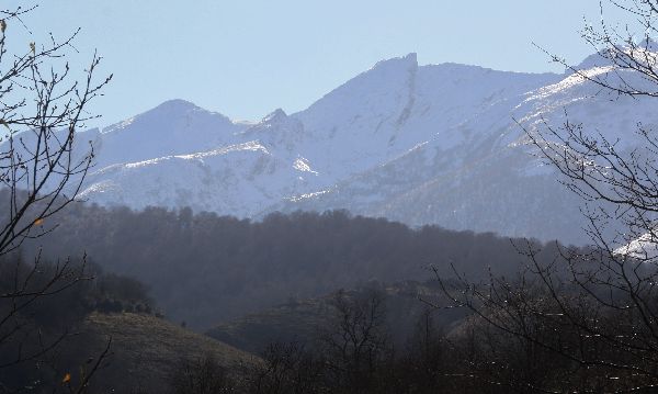
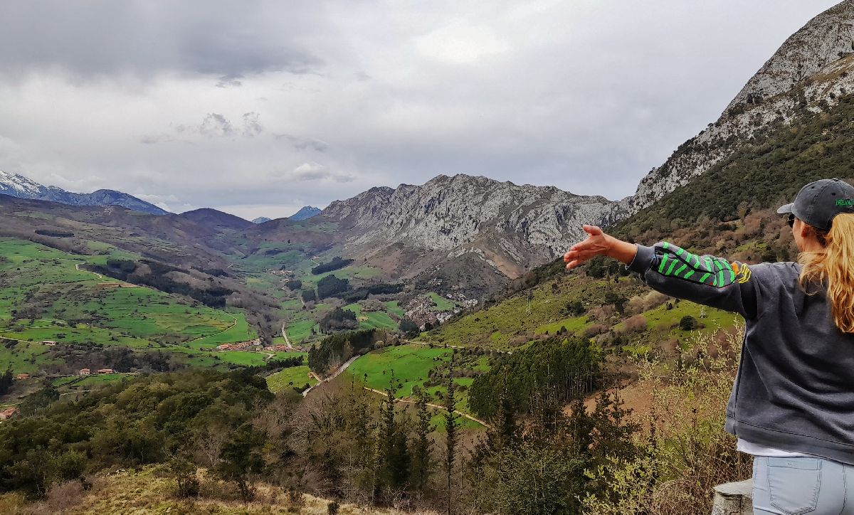
When traveling from Quintanilla to Puentenansa, you must go up through the Collado de Ozalba (or Jozalba as it’s also known). Halfway there, you’ll come across the La Píquere view point. The views from here are STUNNING. Not only can you see the whole valley of Lamasón, but also mountains like Poo peak, the Arria massif, Obán hill, Picos de Europa (Peaks of Europe) and the mountain ranges of Cires, Río and Peña Sagra. It’s the perfect place for a photo!
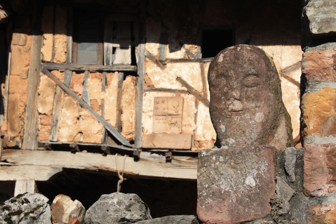
Who and where are they? A bit below Santa Juliana church in Lafuente, there’s a manor that hides two mysterious sculptures of a man and woman in its walls. There’s an inscription on the female figure that says: “CTS pasan que no vuelven. Año 1625” (“CTS pass that do not return. Year 1625”). Some have interpreted CTS to be the abbreviation of “cuántos” (“how many”), thus stating “How many pass that do not return?” Is it referring to the deceased who now rest in the cemetery or the pilgrims on the Camino? Who knows!
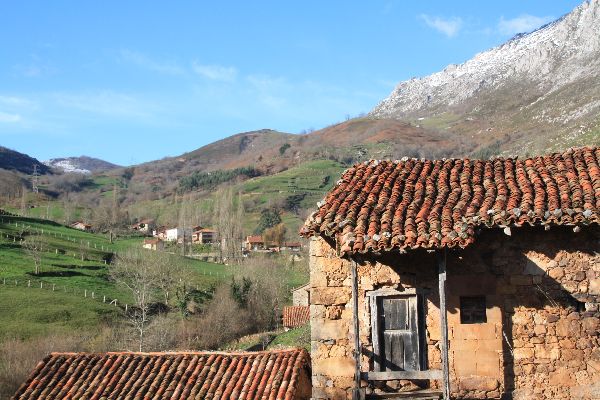
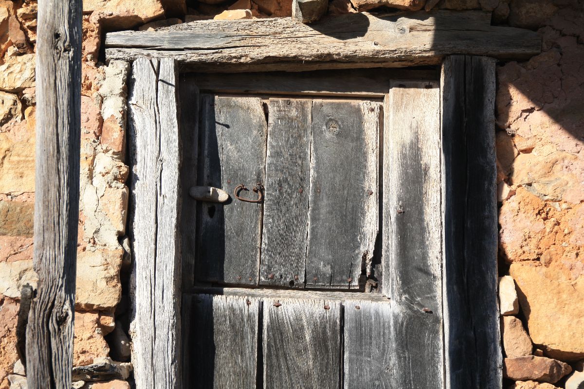
The word ‘invernal’ is closely linked to livestock. It’s a type of cabin built on the fields that are generally far from the villages. Sometimes they’re isolated and other times they’re found in groups, as is the case of those of Tanea. The enclosures around the properties are either walls of stacked rocks with no mortar, or hazel and willow hedges. Its purpose is to store dry grass for the winter upstairs and the livestock downstairs. Lamasón is the place in the region where the most cabins are preserved, thus giving its landscape great cultural value.
Here we’ll give you two options to enjoy and appreciate Lamasón’s wonderful landscape:
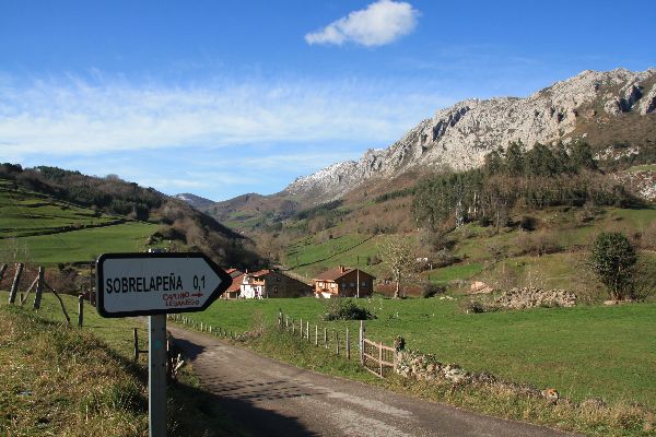
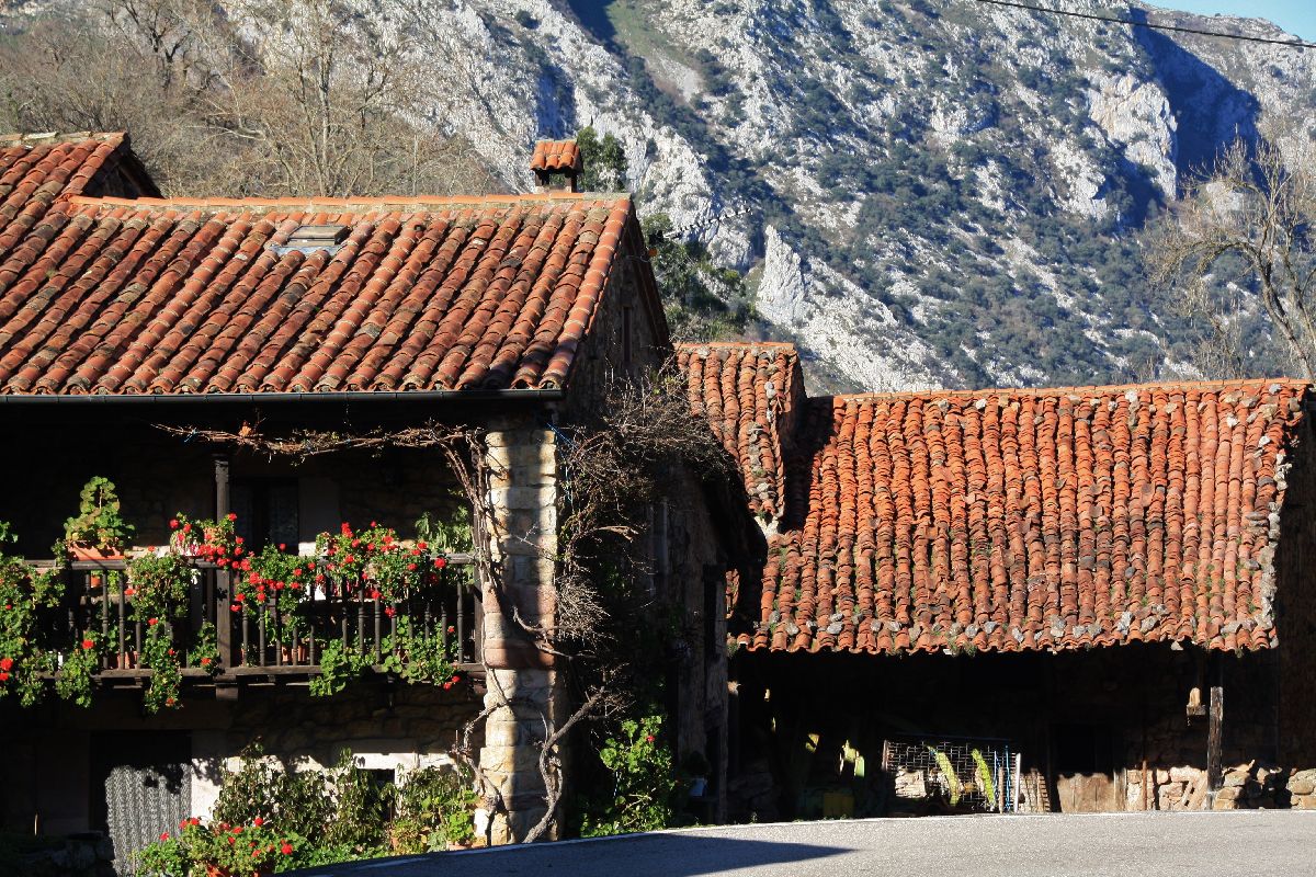
We’ll suggest an easy stroll that’s only a kilometer and a half. You can start in Sobrelapeña, which is where the Lamasón town hall is located. You’ll see that the houses are organized in rows and facing south in order to take advantage of the sunlight. After wandering around, go towards Santa María church, where you may come across some pilgrims on their way to Santo Toribio. The church’s location is strategic and it has some amazing views: the Arria massif, Poo peak, Quintanilla, Sobrelapeña, the Tanea River, the Lamasón gorge and Collado de Joz. The church was built in the 12th century, although it was rebuilt in the 13th century. Its Romanesque façade was preserved, as well as some remains on the inside from that same period. After taking in the sights, continue towards Quintanilla. Once you cross Llampu bridge, we recommend wandering around the streets of the village paying close attention to the houses, vegetable gardens and landscapes. Enjoy your leisurely walk and just take in all of your surroundings.
The Lamasón River—also known as the Tanea River—has carved out the Lamasón gorge in search of the Nansa River. One of the key scenic routes of the area is the one that connects the municipalities of Herrerías (from the village of Cades) with Lamasón. The stretch from Venta Fresnedo to the crossing in Sobrelapeña is the narrowest, but at the same time, the most beautiful. If there have been heavy rains or snow, the roar of the Tanea River is astonishing.
|

 CAMINO LEBANIEGO
 The Camino Lebaniego connects the north and French route of the Camino de Santiago via the Vadiniense Route. All
  SANTA JULIANA CHURCH
 Do you want to play?
 LA PÍQUERE VIEWPOINT
 THE COUPLE OF LAMASÓN
 INVERNALES: COLLADO DE HOZ OR JOZ AND TANEA


