Peñarrubia
 Download the cheat sheet and go!
|
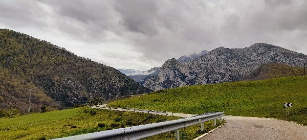
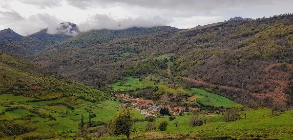
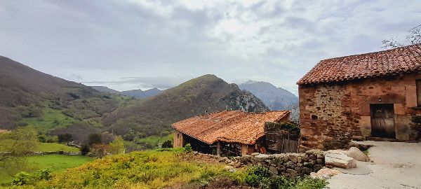
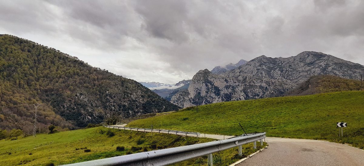
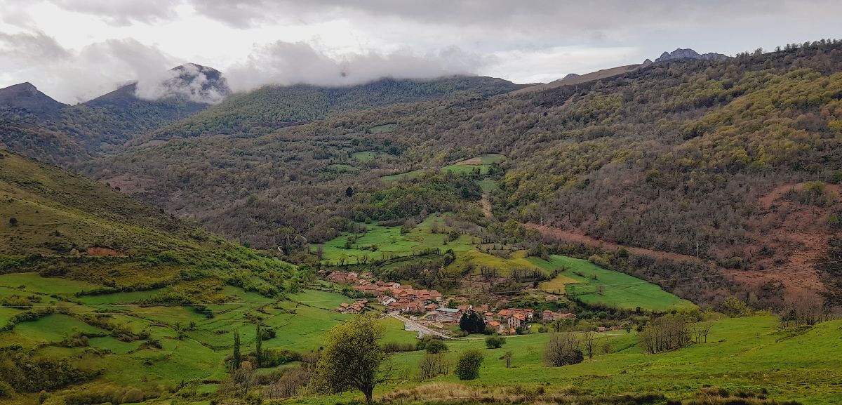
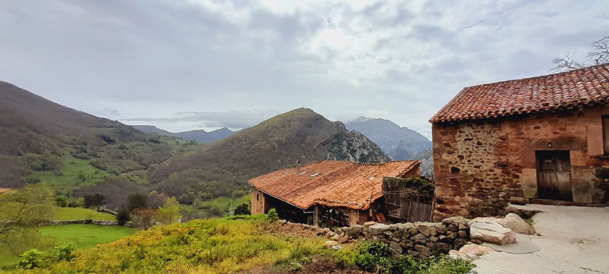
Peñarrubia is surely one of the most mountainous municipalities of the region. It’s made up of 7 villages: Caldas, Cicera, La Hermida, Linares, Navedo, Piñeres and Roza. In Peñarrubia you’ll find paths that will lead you to mythological creatures, waterfalls, hot springs, vias ferratas, medieval structures and a hanging BALCONY that will certainly take your breath away. Shall we visit? Its geography is marked by a long passageway that the Deva River has carved out in its search for the sea: the La Hermida gorge. At 21 kilometers, it’s the longest gorge in Spain and one of the greatest scenic routes for those who love driving. Peñarrubia has been inhabited since Prehistoric times, as evidenced by remains found in the Áurea cave in 2015. Another sign of its long history can be found within the megaliths of Collado de Las Llaves, a group of 5,000-year-old menhirs and dolmens. To understand the strategic importance of Peñarrubia, there’s an essential fact you need to know: the stretch of road between La Hermida and Panes wasn’t opened until the 19th century. Therefore, the only way to access Liébana was through the valleys of Lamasón and Peñarrubia. In the Middle Ages, a time fraught with instability and battles, several structures were built for military purposes. In the Early Middle Ages, the fortress of La Bolera de los Moros, or Mount Santa Catalina, was built as it was the perfect location for controlling the gorge. Centuries later in the Late Middle Ages, the lords’ power grew and they built military towers in a defensive line to patrol the passage between the Deva and Nansa valleys. There were three towers within 1 kilometer of each other: Verdeja, Piedrahita and the Pontón in Linares. When the stretch of road that we all recognize today was opened, all of the villages except La Hermida were excluded from the main route between the coast and Liébana. This relative isolation helped preserved the area’s traditional mountain architecture. So much so, that Cicera received the honor of being named Most Beautiful Village in Cantabria 2022. After giving you a few broad brushstrokes of its history, we’ll reveal more details about the ESSENTIAL things you need to EXPLORE, as well as some interesting facts and recommendations
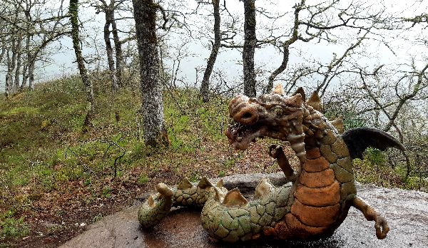
Located in Monte Horzaco, the trail is a really fun way to take a walk with the family and learn about mythological creatures like the ‘anjana,’ the ‘arquetu’ or the ‘trenti.’ Throughout the 1-kilometer journey, you’ll have to look for 15 mythological creatures hidden in the forest. The last character has an extra special treat in store for you...views that will leave you in awe!
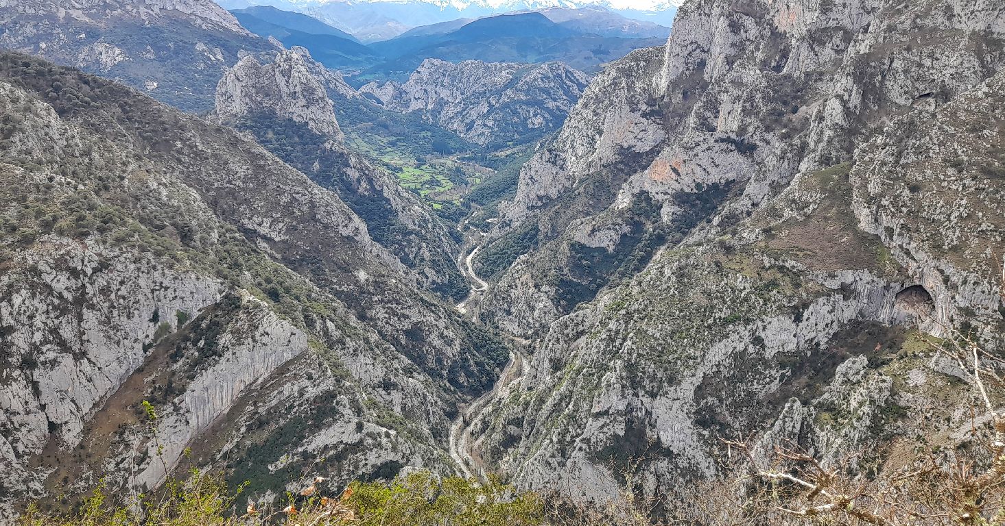
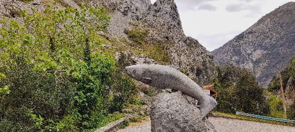
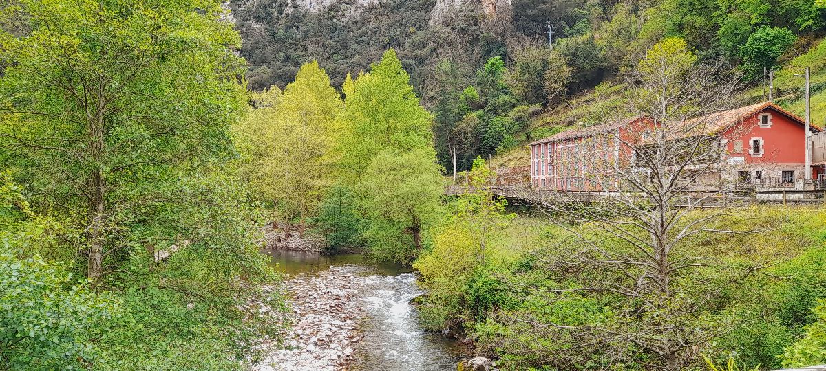
Did you know that the rocks of the gorge were once a seabed millions of years ago? When they reached the surface, the Deva River excavated those rocks leaving us with one of the most amazing places. Galdós described it as: “They call it a gorge, but it can easily be called the esophagus of La Hermida because when passing through, one feels swallowed by the earth.” At 21 kilometers, it’s the longest gorge in Spain. But the route as we know it today (N-621) wasn’t completed until the 19th century when the stretch between La Hermida and Panes was opened to facilitate the transport of wood and minerals from Liébana. In the middle of these limestone mountains is the village of La Hermida. Not only is this village the meeting point of the roads between the Deva and Nansa valleys, but it’s also known for its hot springs. We recommend you take in the beautiful sights, do the via ferrata or visit the remains of the San Pelayo Hermitage from the 13th century.
Known as Santa Catalina or Bolera de los Moros, this lookout point is a BALCONY that literally hangs over the La Hermida gorge. The views from here are absolutely incredible: Picos de Europa (Peaks of Europe), Tresviso, Linares, La Hermida, Liébana and, right at your feet, the gorge. It’s a breathtaking sight that you’re sure to never forget!
We’re right in the middle of the Camino Lebaniego, one of the first pilgrimage routes with its own credentials. The reason so many people pass through is because they’re trying to reach the Monastery of Santo Toribio de Liébana where the Lignum Crucis—the largest fragment of the True Cross—is located. It’s an Año Jubilar (Holy Year) each time the day of Santo Toribio—April 16th--falls on a Sunday. In Peñarrubia, the Camino comes in through Collado de Joz and leads to Cicera; then, it goes uphill to Collado de Arceón and continues towards Lebeña.
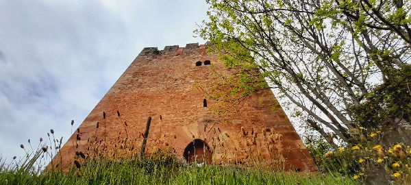
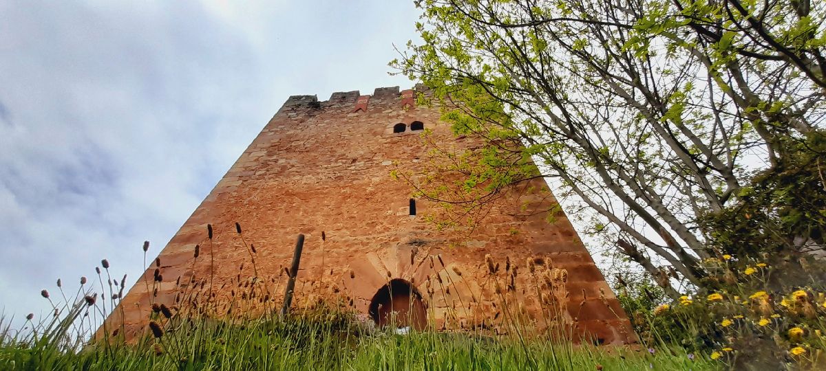
The lord of Linares was the owner and the lord of the valley of Peñarrubia. In order to control and defend his territory, he built a defensive line of 3 towers: Verdeja, Piedrahita and Pontón. The latter is located in Linares and it’s one of the most important medieval structures in western Cantabria and a sign of feudalism*. The tower is a fortress that was manned by few men and used mostly during skirmishes and small sieges. *Feudalism: In the Late Middle Ages, the King distributed land to the nobles in exchange for their support in the wars. The vassals, who, received protection from the feudal lord in exchange for their work, lived on these lands.
Around 5,000 B.C. the way of life started to change and property symbols and burials represented by megaliths began to appear. There are several theories about their purpose: worship, burial, boundary markers or the study of stars. In Collado de Las Llaves, a spot with exceptional views, you can find things like burial plots or dolmens and menhirs.
The via ferrata in La Hermida is perfect for the brave souls looking for an adrenaline kick. It’s a journey around the mountains were you climb both vertically and horizontally and where you can explore a unique environment while you cross bridges and climb iron cramps. To do this activity, it’s vital you have some basic knowledge of climbing and you take your own equipment; however, you can rent the gear and hire a guide.
This could easily be called the Resounding Route due to the roaring sound of the consecutive falls of the agüeras* of Navedo and Cicera. This route is circular and can be started from the gorge or one of the villages. In this case, the track we’re including of the route starts in Navedo. The route follows the old medieval road from La Hermida to the high villages of Peñarrubia; the road was also used to extract minerals from Horarco (or as locals call it, Jozarcu) forest. Throughout the trail you’ll find waterfalls from the Navedo River. Shortly before reaching the road along the gorge, you’ll see a bridge and a small power plant, a building that produced electricity for Navedo and Piñeres. Be very careful when you reach the road because you have to walk for about 1 kilometer and there’s barely any shoulder on the road. A bit ahead of the parking lot by the fishermen’s shelter, is the uphill path along the Cicera River. As you go up, you’ll come across falls from the mills, as well as the Conchapreta and Pozullanu waterfalls. Once you reach Cicera, enjoy a nice walk through the town that was named Most Beautiful Village in Cantabria 2022. We’ve added the mythological trail up to the Santa Catalina lookout to the track before you return to Navedo. This extra stop has a panoramic reward you’re sure to enjoy. *Agüera: a small stream of water. Technical information and recommendations: ► Starts and ends: Navedo / Cicera /Desfiladero La Hermida Notes: 1. We recommend downloading the track of the route on your phone.
The route to the braña de los tejos requires you to be physically fit because you climb 900 meters uphill for 8 kilometers! From Cicera, you should take the Las Cordancas forest trail, a cobblestone path that leads into an oak grove. You pass the remains of the Santa Cilde hermitage, El Murón refuge, groups of cabins, disused coal cellars and remains of past mining activity. Apart from oak trees, you’ll also find grand beeches, birches, holly, rowans and, of course, yews. It’s not common to find a yew forest like this one. These trees are slow growing, have very hard wood and were the sacred tree of the Cantabrians who lived here over 2,000 years ago. One of the characteristics of yews is their toxicity: taxine, the alkaloid it gets its name from (Taxus baccata), is fatal in concentrated doses. It’s said that Cantabrians used it to commit suicide during the Roman invasion. Nowadays, this alkaloid is used in chemotherapy treatments for uterine, lung and breast cancer. The views are amazing throughout the route: if it’s a clear day, you can see everything from the Picos de Europa (Peaks of Europe) to San Vicente de la Barquera. To return, there’s a trail near Collado Arceón that passes between forests and meadows. Another option is to take the same trail you came from. The Climb to the Braña de los Tejos takes place on the first Saturday of August; it’s an event that brings people from both valleys together. Make sure you save the date... Technical information and recommendations: ► Starts and ends: Cicera Notes: 1. We recommend downloading the track of the route on your phone and check the weather forecast beforehand.
|

 MYTHOLOGICAL TRAIL “THE CREATURES OF MONTE HORZACO”
 We’ll leave you with a link to the trail’s website, where you can find a map of the trail, family activities and more information.
  LA HERMIDA AND THE GORGE
 The gorge runs through Asturias and Cantabria and is shared among the municipalities of Peñamellera Baja, Castro Cillorigo, Tresviso and Peñarrubia. More information here:
  SANTA CATALINA VIEWPOINT
 CAMINO LEBANIEGO
 TORRE DEL PONTÓN (PONTÓN TOWER)
 MEGALITHS OF COLLADO DE LAS LLAVES
 VIA FERRATA
